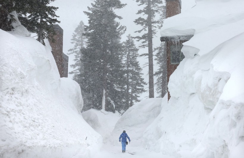
Less than a week after tornadoes ravaged parts of the state, up to three feet of snow was forecast for the Sierra Nevada and other higher elevations.
On Tuesday afternoon, more than 18,000 customers were without power.
California is experiencing yet another round of heavy rain and mountain snow, extending a streak of extreme weather across the West that has been dangerous, deadly, and disruptive to millions of people in recent months.
More Rain and Snow Are Lashing California
 (Photo : Mario Tama/Getty Images)

The latest powerful Pacific storm, known as an atmospheric river, moved inland early Tuesday and is expected to linger through Wednesday, bringing rain to the Central California coast and potentially putting millions of Californians in danger of flash flooding, according to the National Weather Service, as per The New York Times.
The northern coastal ranges and the Sierra Nevada are expected to be hardest hit, with up to three feet of snow predicted.
During California's harsh winter and spring, atmospheric river storms, which get their name from their long, narrow shape and the massive amount of water they carry, have repeatedly flooded communities, trapped residents in snow, caused mudslides, and shut down major roadways.
The National Weather Service in Sacramento reported gusts of up to 68 miles per hour in parts of Northern California as a result of this weather system.
Strong winds were also predicted for southern Oregon and western Nevada.
Because of the hazardous conditions, roads throughout California were closed, including Interstate 80, which was closed between the Nevada state line and Colfax, northeast of Sacramento, after "multiple spinouts," according to the California Highway Patrol in Truckee on Twitter. The highway's reopening date was unknown.
A car flew off an overpass into the street below in Benicia, more than 20 miles northeast of San Francisco, according to the Benicia Police Department on Twitter, adding that no one was injured.
"Please slow down," the cops requested.
The governor's emergency services office advised people to "avoid mountain travel if possible," adding that those who must travel should "keep an emergency bag" with food, water, and a blanket in their vehicle.
Also Read: US Weather Forecast: New Pacific Storm Arriving in California, Severe Thunderstorms in Southeast
More Wet Weather Forecast In South
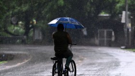
According to AccuWeather meteorologists, the dangerous flash flooding that hit parts of the southern and central United States last week and into the weekend hasn't completely subsided, with the wet pattern continuing on Tuesday.
Through Tuesday, downpours with the potential for flash flooding and severe thunderstorms extended from Louisiana to the Carolina coasts, reaching as far south as Florida, as per USA Today.
Through Tuesday night, rain totals of more than two inches were expected in parts of Louisiana, Mississippi, Alabama, Georgia, and South Carolina.
Heavy rains, fueled by moisture from the Gulf of Mexico, could bring heavy rain and reduce visibility.
This, combined with any ponding on roadways, could be dangerous for motorists and result in slower highway travel.
Prior to the recent severe weather outbreak, much of this zone had been unusually dry.
Some areas, particularly in southeastern Louisiana and the Gulf Coast portions of Alabama and western Florida, are still in a mild drought and could use the rain.
Cities such as New Orleans and Pensacola, Florida, reported only about 40% of their average monthly rainfall amounts as of March 26.
The threat of severe weather is not expected to abate throughout the week.
The United States may experience a brief respite from severe thunderstorms in the second half of this week, another powerful storm is expected to bring damaging storms to the central United States from Thursday evening to Friday night.
Related article: US Weather Forecast: Coastal Storm to Bring Heavy Rain and Snow in New England
© 2024 NatureWorldNews.com All rights reserved. Do not reproduce without permission.


![Roundworms with Short Memories 'Stop Forgetting' When Frozen or Given Lithium [Study]](https://1471793142.rsc.cdn77.org/data/thumbs/full/70295/280/157/50/40/roundworms-with-short-memories-stop-forgetting-when-frozen-or-given-lithium-study.jpg)
