Weather forecast from the National Weather Service (NWS) showed a renewed Pacific storm arriving in California and severe thunderstorms and flooding threat in the southeastern United States in the coming hours and days.
Heavy rain and mountain snow are possible in some parts of the West Coast, especially the Golden State.
Meanwhile, flooding rain, isolated tornadoes, and hail in the Southeast.
The Pacific storm will not only impact California but also southern Oregon from late Monday to Wednesday, March 27 to March 29, the NWS forecast said.
Furthermore, isolated to scattered severe storms are possible across the recent tornado-stricken Georgia into southern South Carolina with giant hail, damaging winds, and excessive rainfall, which could lead to flash flooding.
The continuance of the adverse weather comes several days after a tornado struck western Georgia, leaving several people injured, and almost a week after a destructive tornado rampaged through Mississippi, leaving at least 25 dead.
Similar weather events are expected in the coming days and weeks following the onset of the US spring season on March 20.
NWS Forecast
On Monday, March 27, the NWS' Weather Prediction Center (WPC) in College Park, Maryland stated that a powerful storm system will bring another round of rainy and snowy precipitation in California with cold temperatures.
In addition, the Southeast will experience heavy rain with the potential to cause floodwaters as the severe weather continues across the region.
Moreover, the US weather agency is also monitoring a series of frontal systems with increased precipitation chances for the Northeast US until Tuesday, March 28.
Furthermore, the Great Plains and Great Lakes will receive chilly temperatures and potential snow this week.
The NWS forecast is valid from Tuesday to Thursday, March 30.
During this period, power outages and disruption to travel and public transport are likely, based on previous events this year.
Also Read : Georgia Tornado: Potential Twister Left Multiple Injured as Severe Storms Continue in South US
California Winter Storm System
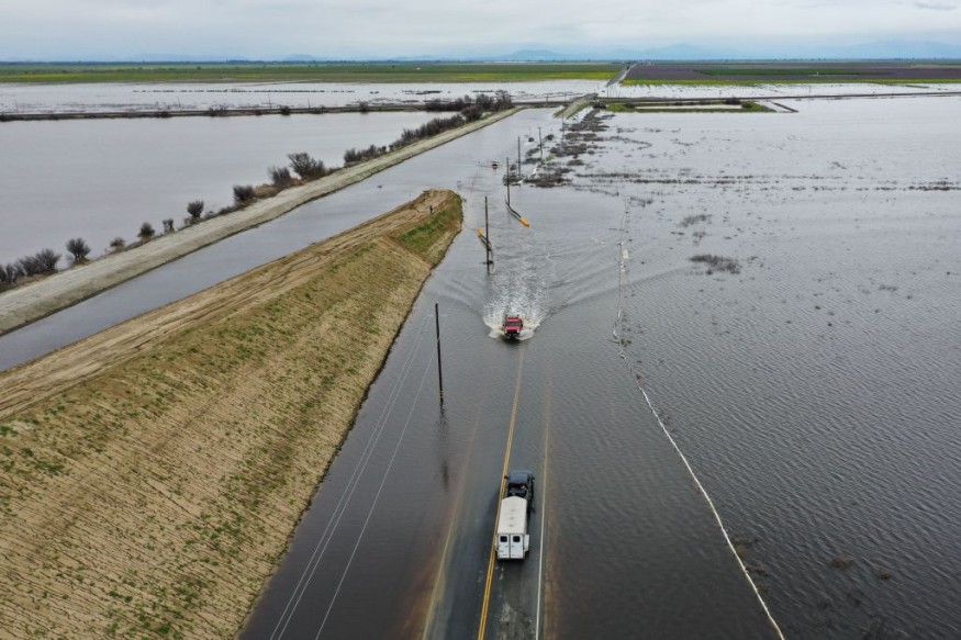
Although spring has started already, winter is not yet done with California.
NWS San Francisco meteorologist, Roger Grass, told CNN that previous storms have saturated soils in California, which will result in falling of trees and potential for further power outages.
Given the amount of rain and snow the atmospheric river has brought to California, the approaching storm will only make the state vulnerable to floodwaters and easily bring down weakened trees, as well as add more snow, according to the forecast.
Southeast Storms
The US region of the Southeast, between the Gulf of Mexico and North Atlantic Ocean, is not exempted from the weather hazards brought by severe weather.
Over the past week, the same weather system was responsible for causing widespread disruption across the South US, as mentioned earlier from the Georgia and Mississippi tornadoes.
The Storm Prediction Center (SPC) stated the area across the region with the highest risk of damaging winds will be from South Carolina to southeast Georgia, as cited by USA Today.
© 2026 NatureWorldNews.com All rights reserved. Do not reproduce without permission.


