Environment
Water Crisis: UN Issues Warning Against 'Thirsty New Technologies' Disguising as Solutions to Depleting Water Resources
The UN warns that “thirsty tech” could lead to more problems rather than solving the water crisis. Click to read more.
Latest Research Articles
Changes In Monthly Temperature Affects Inflation Causing Increase In Food Prices In The World, Study Says
Ocean Surface, Sea Level Rise Increase Due to Strong El Nino, Climate Change in 2023
US Allergy Forecast: Budding Trees and Plants May Impact Allergy Sufferers Nationwide During Pollen Season
Carvings Found in 2,000 Years Old Rocks in Brazil Suggest Settlement Patterns in Ancient Communities
Climate Change Commission Accused Scotland Of Failing To Cut Climate Emission
Dug-out Canoes Used For Fishing, Transport During Neolithic Age Unearthed
Texas Heat Index Increases Faster Than Actual Air Temperature: Scientists Warn
Ancient Humans Survive Climate Extinction Event 900,000 Years Ago During Early Pleistocene Ice Age Transition: New Study Reveals
Microplastic Burden Varies Among Marine Species Based on Ecological Traits
Earth Hour 2024: Does the Global Environmental Movement of Switching Lights Off 'Really' Help Protect Our Planet?
WHO Air Quality: Vast Majority Of Countries Fail To Meet Standards
Microplastic Pollution: These Tiny Particles of Whole Plastics Confirmed for the First to Threaten Human Health [Study]
MOST POPULAR
-

Why Winter Storm Fern Actually Proves Climate Change Is Real—Not a Hoax
-

How the Polar Vortex and Warm Oceans Are Driving Extreme US Winter Storms in 2026
-

Why Healthy Soil Is Vital for Life on Earth: Boost Crops, Biodiversity, and Ecosystem Health
-

3I/ATLAS Update: What Did ExoMars Trace Gas Orbiter Capture at Close Range Before Comet Disappeared Behind the Sun?
-
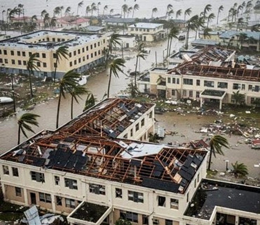
Hurricane Melissa Targets Southeast Bahamas and Bermuda After Historic Category 5 Jamaica Landfall


