The threat of severe thunderstorms can return to the Northeast Interstate 95 corridor after the warmer trend outlook. As Memorial Day weekend comes near, there is a chance that the severe weather could lead to slower commutes or hazardous travel.
A recent FEMA report forecasts severe weather in parts of the U.S. The advisory reminds Americans to keep updated with the latest forecasts, including potential risks of extreme heat, flash flooding, and isolated tornadoes.
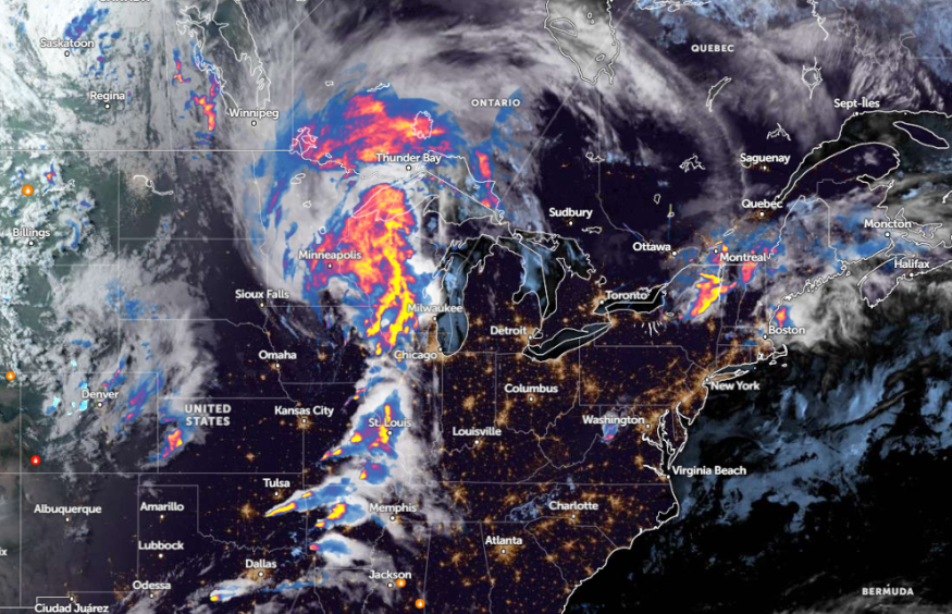
In nearby areas, a National Weather Service (NWS) forecast warns of showers and storms in the Midwest. Commuters should keep alert for strong tornadoes and damaging winds.
Weather in Parts of Northeast: Where Will Severe Thunderstorms Unload?
According to a weather report on May 22, the latest forecast warns of a stormy outlook in parts of the Northeast, particularly along I-95. The early week's weather outlook reveals that near-record warmth could unfold. Residents can notice increasing humidity and temperatures up to the upper 80s F.
The hotter weather outlook can occur in the following areas:
- Altoona
- Scranton
- Binghamton
- Syracuse
- Albany
- Concord
- Burlington
- Montreal
The forecast monitors a warm and sunny outlook in New York. Residents in the west and north of NYC can experience temperatures reaching the upper 80s. Meanwhile, the interior of Connecticut can expect lower to middle 80s.
For Boston residents, there is a low risk of showers and isolated thunderstorms this week. On Thursday, a widespread risk for storms can unload, with a chance of thunder.
On Wednesday, a chance of rain and thunderstorms can spread in the following areas:
- Burlington
- Buffalo
- Pittsburgh
- Columbus
- Charleston
- Detroit
- Washington
Additionally, commuters should watch out for the potential development of thunderstorms this week. People with travel plans should consider the latest weather report in the Northeast.
There is a high chance of severe thunderstorms on Thursday. The forecast warns of heavy downpours, hail, and flooding. The challenging weather outlook can affect daily commutes, resulting in travel delays. The areas at risk are Washington, Richmond, Philadelphia, New York, Boston, and Hartford.
Read also: New York, Boston Weather Forecast: Temperatures Likely to Soar Midweek as Unofficial Summer Begins
Northeast Weather Preparedness for Memorial Day Weekend
The latest weather forecast warns of a poor weather outlook in the Northeast this late week. Residents can likely experience possible severe thunderstorms, which could cause flood concerns and localized damaging winds.
Commuters should stay updated with this week's latest forecasts to avoid severe thunderstorms and heavy downpours. Checking the road conditions before traveling is essential to limit possible hazards.
Additionally, there is a risk of hail. Strong winds can damage powerlines, leading to power outages. Homeowners can also store emergency kits, as roads could be inaccessible or flooded. The recommended emergency kits are battery-powered radios, medicine kits, canned goods, and bottled water supplies.
Read also: Memorial Day Weekend Weather: Severe Weather Likely to Unload from Arkansas to Mid-Atlantic
For more similar stories, don't forget to follow Nature World News.
© 2026 NatureWorldNews.com All rights reserved. Do not reproduce without permission.


