Widespread above-average temperatures can occur in the Eastern U.S. this week, according to a report by the National Weather Service (NWS). Commuters can potentially expect relief from the recent rainy outlook.
NWS report reveals that above-average temperatures can also occur in the Southeast this week, including in the Northwest.
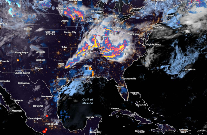
Additionally, severe thunderstorms can still threaten portions of the Tennessee Valley, Southern Plains, and Ozarks.
Weather in the Eastern US and Gulf Coast This Week
The latest weather report shows a warm weather outlook can unfold in the eastern U.S., southern Texas, Gulf Coast, and Southeast. Daily highs can reach from 10 to 15 degrees above average. The weather conditions can be favorable for outdoor plans, but homeowners should still keep alert for a chance of precipitation.
In New York City, the forecast reveals that a cooling outlook could return Thursday through the weekend. There is a threat of widespread showers on Friday, and the thunderstorm outlook could threaten portions of the Interstate 95 corridor.
In a recent advisory in Boston, possible showers and thunderstorms could spread in the morning. For Pittsburgh residents, severe weather potential will be likely as the forecast monitors the development of a new low pressure advancing into the Ohio Valley.
In Chicago, scattered thunderstorms can affect parts of the region, with strong winds and large hail. Residents can also expect a sunny and warm outlook this midweek and the weekend.
Damaging Thunderstorm Concerns
Flooding risks are likely in the Gulf Coast this week, with renewed flooding from Texas to Florida. In midweek, the weather outlook could bring severe thunderstorms, with widespread damaging winds and flash flood in the following areas:
- Des Moines
- Peoria
- St. Louis
- Springfield
- Dallas
- Little Rock
- Nashville
- Louisville
- St. Louis
- Roanoke
- Raleigh
- Charlotte
- Louisville
NWS Des Moines reveals that challenging weather outlook can threaten central and eastern Iowa, including in the interstate 80. Homeowners should check for a brief heavy rainfall.
The report shows that multiple severe thunderstorms can unload in St. Louis. In Raleigh, there is a risk of a stormy outlook in the southern Coastal Plain and Sandhills. Residents can also anticipate light rain.
On Thursday, enhanced tornado risk can occur in Paducah, Nashville, Lexington, and Jonesboro. With the potential poor weather outlook, people are advised to keep updated with the latest forecasts.
Additionally, households can consider storing emergency kits, which include important food packs, bottled water supplies, and medicine kits.
On the weekend, brief downpours and gusty winds can unload in the following areas:
- Green Bay
- Chicago
- Indianapolis
- Knoxville
- Pittsburgh
- Detroit
- Toronto
When severe weather worsens, people should stay at home or reconsider their daily commutes. Travelers should be extra careful when commuting to stay safe from dangerous road conditions.
Read also: Gulf Coast Weather Forecast: Widespread Damaging Winds, Lightning Strikes Likely to Threaten Midweek
For more similar stories, don't forget to follow Nature World News.
© 2026 NatureWorldNews.com All rights reserved. Do not reproduce without permission.


