Isolated tornadoes and severe thunderstorms are likely in Louisiana to Southwest Mississippi, according to a National Weather Service (NWS) advisory. Residents should stay alert for potential road dangers and slower commutes associated with the weather.
The beginning of April brought significant travel concerns to parts of the US, particularly in the southern parts. Residents were advised to stay updated on flooding concerns, including travel dangers and damaging winds. However, the main threat was isolated tornadoes, which could cause power outages and house damage.
Additionally, the forecast monitors the development of a strong cold front and very rough sea conditions in portions of the northeastern Gulf of Mexico, northeast Florida, Atlantic water, and northeast Florida. On Wednesday, frequent southerly gusts and rough-to-high seas can occur.
Meanwhile, the forecast issued a Severe Thunderstorm Watch in Central Texas. Residents should also watch out for damaging winds reaching up to 70 mph. Potential tornadoes can also threaten the affected areas.
Severe Thunderstorm Concerns in Louisiana and the Southwest US
The NWS Storm Prediction Center issued a tornado watch in parts of Texas, with a few potential strong tornadoes. The threat can be accompanied by hail and scattered damaging winds. The strong winds can lead to tree damage or flying debris, and limiting outdoor plans is recommended to keep safe from the weather.
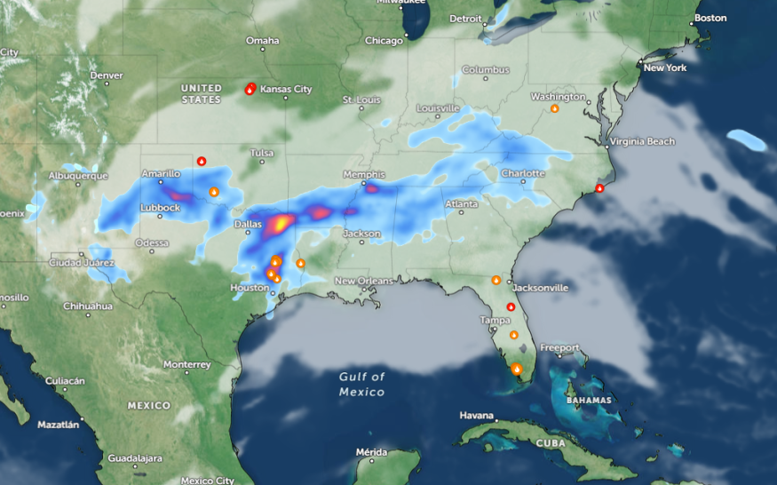
In addition, an NWS report shows that the severe thunderstorms can threaten portions of Texas towards the Lower Mississippi Valley on Wednesday morning, spreading over the Gulf Coast States in midweek.
The NWS Short Range Discussion monitors a weather pattern in the Southern Plains and Lower Mississippi Valley this week, bringing potentially hazardous weather. People with travel activities should keep updated with the latest forecasts to avoid the threats of flash flooding and flooding rainfall.
In East-Central Texas and parts of Western Mississippi, widespread damaging gusts can be possible. On the other hand, a strong thunderstorm is possible in the Carolinas and northern Florida, including the Ohio Valley. Flash flood threats can unload in the Southern and Central Appalachians.
In addition, a strong southerly flow along the East Coast can unload on the East Coast, Southeast, to Mid-Atlantic.
On Wednesday, warm conditions are possible in Jacksonville, Tampa, Miami, and Raleigh. On the other hand, rain and thunderstorms are likely in Little Rock, Nashville, Atlanta, Montgomery, New Orleans, Jackson, and Jackson.
Isolated Tornadoes Weather Preparedness: How Can People Stay Safe?
Isolated tornadoes can possibly threaten portions of the U.S., bringing potential weather threats. As a result, staying updated with the latest forecasts is essential to stay away from challenging weather.
Furthermore, homeowners can prepare emergency kits at home or in vehicles, which are helpful during challenging weather conditions. People can have flashlights, battery-powered radios, medicine kits, batteries, and bottled water.
Related Article : Northeast Flooding Forecast: Heavy Rains, Damaging Thunderstorms to Bring Travel Dangers This Week
For more similar stories, don't forget to follow Nature
© 2026 NatureWorldNews.com All rights reserved. Do not reproduce without permission.


