Experts have recorded thousands of tremors around Fagradalsfjall Volcano, prompting authorities to raise the state of emergency.
The Icelandic Meteorological Office said that officials have already directed thousands of individuals residing in the southwestern town of Grindavík to leave in order to ensure their safety amid the considerable risk of eruption.
Seismic Activities
Authorities noted that around 1000 earthquakes within the dyke boundaries have been recorded since midnight, with models showing a 15-km long magma intrusion, located just northwest of Grindavík.
The Icelandic MET Office said that since the morning of November 11, seismic activities related to the magma intrusion remain fairly constant.
On the other hand, authorities said that since midnight of November 12, around 1000 earthquakes have been recorded within the dyke, and all of them have been below M3.0 in magnitude.
Authorities said that most of the seismic activities have been located in the region north of Grindavík. Most of the earthquakes are at a depth of 3-5 km corresponding to the lower part of the dyke intrusion.
Based on GPS measurements covering the past 24 hours, the deformation associated with the dyke intrusion that formed on Friday, November 10, has slowed down.
This can be an indication that magma is moving closer to the surface and that new models will be running as soon as new data comes in to update the model.
Officials reminded that it is necessary to increase the vigilance of the area through additional monitoring with the aim of improving the detection of magma reaching the surface.
Furthermore, it was the opinion of the scientists that it would be advisable to start these operations immediately as uncertainty about the progress of the event grows as each day passes through.
The final decision on whether these actions will be taken as well as the implementation is in the hands of public safety and the police chief in Suðurnes.
Because of the the increased seismic activities in the area, authorities were forced to issue closure of the nearby Blue Lagoon landmark.
More than 20,000 tremors have been recorded in southwest Iceland since late October.
Read Also: A Look Inside the Earth: Iceland Volcanic Eruption Opens Opportunitites for Extensive Study
Possible Eruption Site Still Unknown
Meanwhile, the exact location of the possible eruption site is still unknown, however, the 15-km length and orientation of the dike gives a good indication of possible sources.
The overall assessment from the officials' meeting was that the likelihood of a volcanic eruption is high, and that an eruption could be possible on a timescale in just a matter of days.
Authorities noted that based on the extent of the dike, magma could emerge from the southern portion, just outside of Grindavik.
This means that the likelihood of a submarine eruption has also increased, so preparations must be made for the possibility of explosive activity.
Moreover, a hazard area has been defined based on the location of the dike.
Iceland has been dubbed as one of the most geologically active regions in the world, with around 30 active volcanic sites.
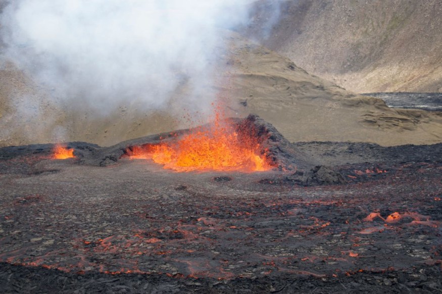
To recall, Litli-Hrutur, or Little Ram, erupted in the Fagradalsfjall area. This natural disaster drew tourists to the site of the "world's newest baby volcano."
Officials said that the site was dormant for eight centuries until eruptions in 2021, 2022 and 2023.
Related Article: Iceland Volcano Erupts Near Capital After A Strong Earthquake Struck
© 2026 NatureWorldNews.com All rights reserved. Do not reproduce without permission.


