Meteorologists said that Post-Tropical Cyclone Lee has turned monstrous as it pounded Nova Scotia and Maine.
Lee, once categorized as Hurricane Category 5, battered New England and Canadian Maritimes and toppled down the power supply in more than 280,000 electric customers across Maine, Nova Scotia and New Brunswick.
Lee, the third named storm to make landfall in North America amid the hurricane season, had claimed the life of one individual in Maine.
Authorities said that a 51-year-old motorist died after a large tree limb fell on his vehicle amid the powerful winds.
Weather track
The National Hurricane Center and Central Pacific Hurricane Center said that at around 800 PM AST (0000 UTC), the center of Post-Tropical Cyclone Lee was spotted near latitude 44.7 North, longitude 66.3 West.
The post-tropical cyclone is tracking the direction toward the north near 14 mph (22 km/h).
Weather forecasters said that a faster northeastward motion is expected during the next day or so, taking the system across the Canadian Maritimes.
Meanwhile, the maximum sustained winds are near 65 mph (100 km/h) with higher gusts.
On the other hand, steady weakening of Lee has been forecasted to happen during the next couple of days.
The tropical-storm-force winds extend outward up to 320 miles (520 km) from the center.
Meanwhile, an observing site on Beaver Island, Canada had reported a sustained wind of 48 mph (78 km/h) and a gust to 63 mph (102 km/h).
Meteorologists said that the estimated minimum central pressure is 979 mb (28.91 inches).
They also said that the tropical storm conditions, which are occurring along the coasts of Maine and Nova Scotia, would spread northward within the tropical storm warning areas through the evening.
The strong winds also resulted in electric outages and uprooting of trees.
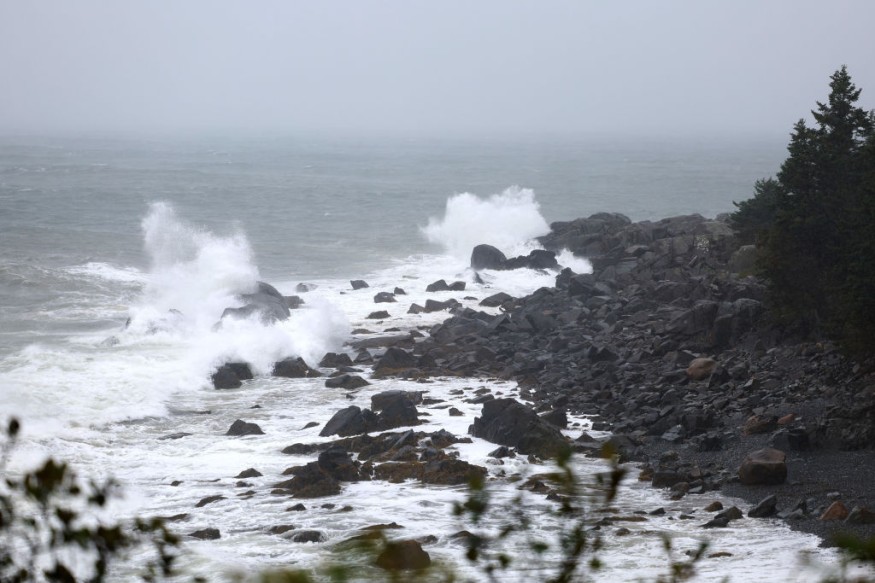
On the other hand, the swells generated by Lee are presently affecting Puerto Rico, Hispaniola, the Turks and Caicos Islands, the Bahamas, Bermuda, the east coast of the United States, and Atlantic Canada.
Officials warned that these swells could likely cause life-threatening surf and rip current conditions.
Lee is also seen to produce an additional one to two inches of rain, or 25 to 50 millimeters, across areas of eastern Maine and New Brunswick.
This condition may produce localized urban and small stream flooding.
Furthermore, a dangerous storm surge will produce coastal floods within the wind warning areas in Atlantic Canada in areas of onshore winds.
Near the coast, the surge will be accompanied by large and destructive waves.
Lee's landfall
According to meteorologists, Lee made landfall over Long Island, located on the southwestern extent of Nova Scotia.
On its final approach to landfall, Lee lost some of its tropical characteristics that later resulted in its fury to grow.
Tropical storm-force winds had extended roughly 400 miles from the storm's center while hurricane-force wind gusts had spanned around 150 miles from its eye.
Many popular tourist destinations in Maine have been closed ahead of Lee's arrival, including Acadia National Park as well as the business establishments in Bar Harbor that are located outside the boundary of the park along the coast.
Moreover, the airports in the region have also been temporarily closed prior to Lee's arrival, including Halifax Stanfield International Airport in Nova Scotia, where all flights scheduled for Saturday had been canceled.
Also, more than 220 flights at Boston Logan International Airport were canceled as winds in the airport frequently gusted over 40 mph on Saturday afternoon.
Related Article : Hurricane Lee Seen To Create Autumn Conditions In Eastern US
Related Video:
© 2026 NatureWorldNews.com All rights reserved. Do not reproduce without permission.


