Hurricane Margot is not expected to bring stormy conditions to parts of the US as it moves over the Azores. The storm has a maximum sustained winds of 75 mph.
The early September unleashed severe weather conditions in the US, from extreme heat to hurricane conditions. Weather agencies are on alert for the development of new storms that could impact the country.
September is active in potential hurricane and stormy conditions. It is best that Americans should keep updated with the weather this month.
Hurricane Margot: Where will it impact?
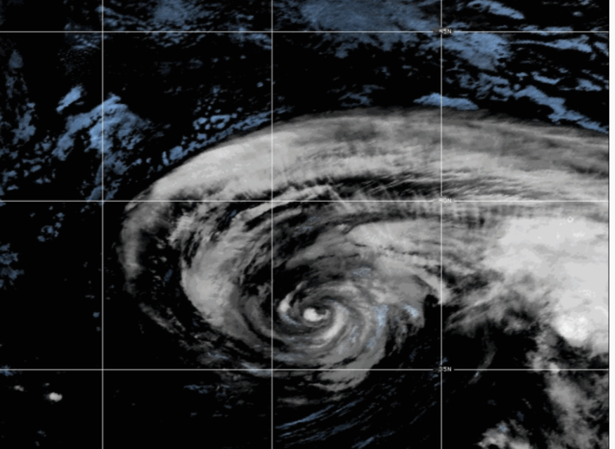
The National Hurricane Center (NHC) reported that Hurricane Margot was located over the Azores. It moves east-northeast at three mph.
The hurricane is not expected to affect parts of the US.
In the Azores, challenging surf and rip current conditions until early next week.
As of September 15, the hurricane reached maximum sustained winds of 5 mph (120 km/h) with higher gusts.
On Saturday, Margot is expected to weaken, downgrading into a tropical storm gradually. The forecast said it is too early whether Margot could make landfall as it will weaken this weekend.
In the Caribbean and Tropical Atlantic, challenging to moderate sea conditions and winds are forecast until the early week.
On the Tropical Atlantic, NHC noted that thunderstorm conditions and rain showers could be likely in parts of the Cabo Islands and Lesser Antilles in the coming days.
The developing system could likely become a tropical depression.
Furthermore, Hurricane Lee will likely bring dangerous surf and severe weather conditions in parts of New England and Atlantic Canada this weekend.
Lee is seen moving at 15 mph over the Western Atlantic as of September 14's advisory.
The hurricane could likely gradually weaken this weekend. Storm Surge Watch is in effect in parts of Nantucket, Cape Cod and Southeastern Massachusetts, as strong winds and heavy rain could start on Friday.
Also Read : US Weather Forecast: Widespread Showers, Thunderstorms to Unload in Colorado, Wyoming, Utah This Week
Hurricane conditions: Important safety tips
Powerful hurricanes can cause the following weather events:
- Severe flooding
- Mudslides
- Landslides,
- Power outages and inaccessible roads
The rapid development of hurricanes can become deadly, causing significant damage to lives and communities.
As a result, weather preparations are essential to prevent possible devastating damages from the stormy outlook. Here are essential hurricane reminders this weekend.
Stay at home as possible.
Homeowners should limit any outdoor activities this week, especially if hurricanes affect them. Staying updated with the weather outlook helps to prepare better for hurricanes or storms.
Watch out for flooding and flash flood risks.
Flooded roads are also likely this week. Meanwhile, people in flood-prone areas are at risk of flood. Homeowners should watch out for possible flooding and immediately evacuate to nearby shelters.
Always keep emergency kits at home.
As hurricanes continue to develop, having emergency home kits is helpful when roads become inaccessible.
Related Article : Heavy Rainfall to Hit in New England, Northeast This Week; Flood Watches Present in Connecticut into New Hampshire
For more similar stories, don't forget to follow Nature World News.
© 2026 NatureWorldNews.com All rights reserved. Do not reproduce without permission.


