Severe storms are threatening to continue disrupting Fourth of July holiday plans, according to reports. This comes as the East Coast weather forecast is not going well for the region, with damaging winds and isolated tornadoes being the main weather hazards. Flash flooding due to heavy rain, as well as hail, are also possible in the coming hours and days.
The severe weather across the East Coast coincides with the extreme heat enveloping the southern United States. With this, U.S. meteorological authorities have issued excessive heat alerts for millions of Americans nationwide. The said heat advisories show potential risks associated with high temperatures and dry conditions such as heatstroke and heat-related illnesses.
Severe Storm Threat
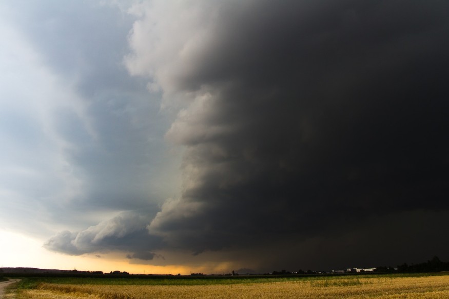
Meteorologists said the main threat for millions of people across the US is hurricane-force winds and the potential formation of some twisters, according to meteorologists.
Weather experts relate these threats to the severe thunderstorm watch along the Texas/Oklahoma panhandle. Yet, the overall risk zone spans from Arkansas to New Jersey on the East Coast, ABC News reported.
In the Eastern Seaboard and its surrounding regions, millions of Americans are affected in the following states such as:
- Arkansas
- Illinois
- Indiana
- Kentucky
- Tennessee
- Alabama
- Georgia
- Ohio
- Mississippi
- Missouri
- North Carolina
Also Read: Severe Storms with Damaging Winds and Tornadoes to Hit the Central United States This Coming Week
Fourth of July Weather
The Fourth of July holiday is several hours away and the latest U.S. weather forecast shows that clusters of storms are anticipated to occur on the afternoon and evening hours of Monday, July 3.
According to the National Weather Service (NWS), isolated to scattered severe thunderstorms, accompanied by localized heavy rainfall, are forecasted in some parts of the Great Plains and states in the eastern U.S.
The NWS explains that the adverse weather in the region is caused by "very warm and moist air" ahead of a low-pressure wave currently traversing the lower Great Lakes into New England in the coming days. This entails that the stormy weather could continue even beyond the Independence Day holiday on Tuesday, July 4.
The thunderstorm threat on Monday follows the severe weather that occurred across the eastern U.S. on Sunday, July 2, when the NWS recorded almost 300 combined reports about tornadoes, hail, and wind damage from the Mississippi River to the East Coast, Fox Weather.
Air Travel Disruption
As said earlier, the severe storms have continued to affect air travel in and out of the U.S. since last week.
According to the website FlightAware, there are a total of 1,620 delayed flights operating within the U.S. and 100 canceled flights as of Monday afternoon.
Over the past week, the JFK International Airport and other airports across the Northeast U.S. experienced flight cancellations and delays, including in other parts of the country, due to the persistence of severe storms.
© 2026 NatureWorldNews.com All rights reserved. Do not reproduce without permission.


