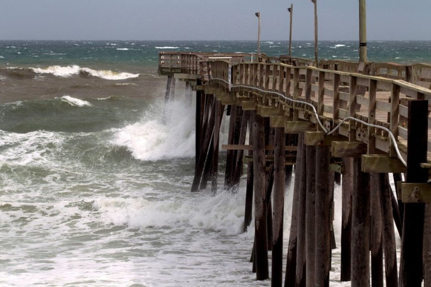
An Atlantic storm will continue to threaten the Eastern Seaboard, especially the southeastern United States, with dangerous surf and rip current conditions due to powerful gusty winds until Sunday, May 28, according to the National Weather Service (NWS).
The weather disturbance could also produce heavy rain and may result in inland flooding, in addition to the potential coastal flooding.
The coastal storm has been developing off the Southeast U.S. for several days already, ahead of the 2023 Atlantic hurricane season, which will start on June 1 and last until November 30.
The U.S. weather authorities are expecting the upcoming season to be "near-normal."
This means that the long-term forecast estimates that only fewer storms will form or intensify into hurricanes compared to last year.
As the current spring season is nearing its end, temperatures are expected to increase in other parts of the nation next month, which is also the start of the summer season.
Still, severe thunderstorms with isolated tornadoes and flooding due to rainfall events are still possible, based on previous events in the U.S. during the same period.
Atlantic Storm Update
In recent days, Fox Weather forecasters initially predicted that the Memorial Day weekend weather will be met with various conditions such as torrential rain, gusty winds, and high ocean waves along the East Coast.
The forecasters said this is especially the case from the Carolinas to the Southeast Coast.
Now, the National Weather Service (NWS), through its department the Weather Prediction Center (WPC), on Saturday, May 27, described a "convective low pressure system" is set to bring wet weather conditions and hazardous beach, boating conditions through the Southeast and Mid-Atlantic region during the Memorial Day weekend.
Memorial Day Weekend Weather
In another update, The Weather Channel reported weather conditions for the Memorial Day weekend will remain stagnant due to an "elongated jet stream" that could impact not only the East Coast but also the Lower 48 states.
In the forecast, the jet stream could also impact the Great Plains and northern Rockies, in addition to the Southeast and mid-Atlantic.
This coincides with the convective low pressure system hovering over the Atlantic waters that was mentioned by the WPC.
However, the evening hours of Saturday until Sunday morning could see coastal communities across the Southeast experiencing high surfs and life-threatening currents.
Potential Travel Disruption
Previous weather reports have also mentioned the potential travel disruption that the incoming Atlantic storm might cause across the Eastern Seaboard and other parts of the country.
If inclement weather occurs, air travel could be the most affected with the potential for cancelled or delayed flights nationwide.
During the 2022 Memorial Day weekend, more than 7,000 flights were cancelled worldwide, with some being due to bad weather and "air traffic control action," according to a cited report by CBS News.
© 2026 NatureWorldNews.com All rights reserved. Do not reproduce without permission.


