Wet and chilly weather has entered the U.S. East Coast due to a strengthening storm system, according to the National Weather Service (NWS). Starting Monday, May 1, potential flooding due to heavy rain is possible across the Northeast and Mid-Atlantic regions.
Meanwhile, severe thunderstorms are possible across the Carolinas into the Mid-Atlantic and parts of central-southern Florida.
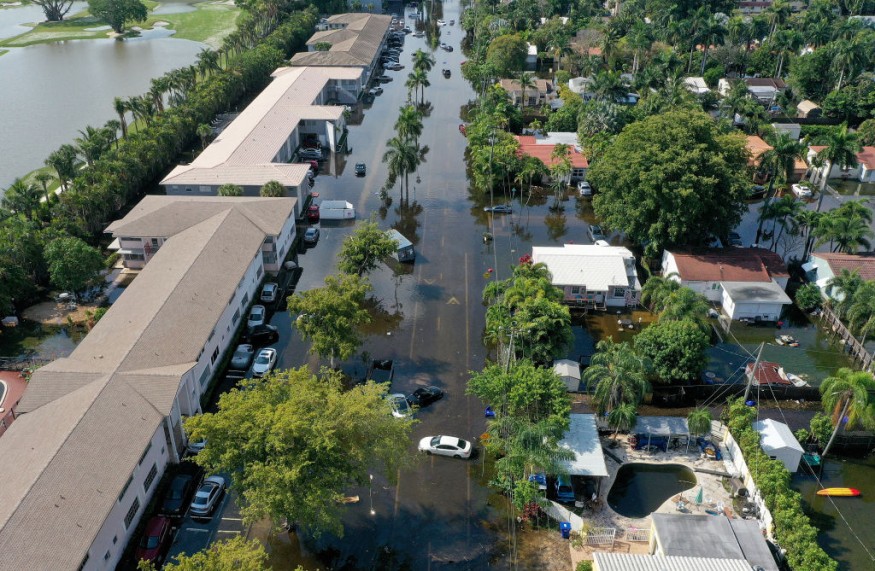
In recent days, the NWS initially issued a weather forecast regarding the development of the storm in the Eastern U.S. where it would make an impact over the weekend until early this week.
The previous weather report also said that rainfall and floodwaters to be the main risks brought by the weather system.
The extended forecast this week means power outages and travel disruptions are still possible.
In addition, meteorologists reported in their latest forecasts that severe thunderstorms are also possible along the East Coast, a region already battered by torrential rain.
Amid the new threat, forecasters warned about the possibility of isolated tornadoes due to the severe storms, which recently affected Florida and surrounding regions in the country in the past few weeks.
East Coast Weather Forecast
A deep upper-level trough hovering above the Great Lakes region and strong surface low-pressure system are expected to navigate from the Mid-Atlantic into the Northeast starting Sunday evening, April 30.
This movement will produce unsettled weather by the beginning of May from the Midwest to the East Coast, according to the NWS' Weather Prediction Center (WPC).
The weather service adds that other weather conditions linked with the powerful "Eastern U.S. spring storm."
These other storm hazards include gusty winds over the Midwest region. In addition, below-normal temperatures are also forecasted for the eastern portion of the country.
Wind strength may reach 45 miles per hour until Monday. Similar wet weather conditions are likely to continue in the next few days.
East Coast Severe Weather
As storms navigate the East Coast as of Sunday, a tornado was reported in the city of Virginia Beach, Virginia, according to Fox Weather, which reported that the twister downed a tree and pinned it onto a vehicle near Great Neck Middle School, trapping at least one person inside.
A local state of emergency was declared after the Virginia Beach tornado damaged approximately 50 to 1000 homes, as well as disrupted power, NBC News reported.
Virginia officials said the tornado damaged dozens of homes, downed trees, and temporarily cuts power to 2,000 customers by Sunday evening.
The East Coast severe weather started last Friday, April 28, and brought wet weather to the Carolinas and Mid-Atlantic before traversing towards the Northeast.
With this, there is an increased danger of flash flooding for some areas of Massachusetts, New Hampshire, and other states, Fox Weather added.
Moreover, the storm system also puts New York, New Jersey, Pennsylvania, and Washington at risk of floodwaters.
A flood alert remains in place in multiple cities across the region, which highlights the increased chances of rain.
© 2026 NatureWorldNews.com All rights reserved. Do not reproduce without permission.


