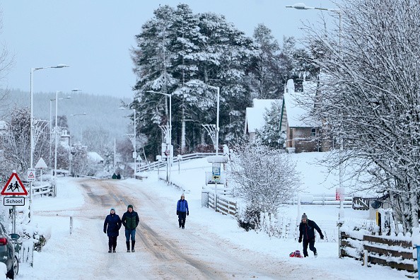
A wall of snow could fall on the United Kingdom as a winter storm threatens subzero temperatures.
According to some computer modeling, there is even a risk of "widespread snow," although others say that is unlikely.
Forecasters stated that freezing air from the United States could collide with warmer air from the Gulf of Mexico, resulting in a supercharged jet stream and colder conditions.
A Mild Start With Persistent Cloud And Possible Drizzle
Met Office Issue Yellow Warnings For Snow Across The UK. Weather agencies reported that the weather conditions in the United Kingdom (U.K) could unload heavy rain and challenging winds this week. Jeff J Mitchell/Getty Images
Forecasts from the United States predict colder weather here, while the Met Office in the United Kingdom predicts rain and milder conditions, as per SomersetLive.
Some computer models are now favoring a bitter easterly blast later next week, and this could bring the risk of widespread snow, Exacta Weather's James Madden told the Mirror Online.
This is expected to happen before next weekend; if it does, temperatures will drop across the country.
Snowfall in some areas could cause disruption, and depending on the severity of the blast, this could be on par with or worse than anything we've seen so far this winter.
Temperatures could drop to -10°C or even -15°C in some urban areas during a cold spell that could last seven to ten days.
According to Met Office meteorologist Aidan McGivern, a large area of cold air across North America is colliding with milder air to the south, and we're getting a powerful jet stream, which is helping to deepen areas of low pressure.
Although the jet stream deepens an area of low pressure, the size of that low affects the shape of the jet stream and helps to push its energy southwards and northwards, amplifying the jet stream.
The Met Office has predicted snowfall in the United Kingdom this month, with specific dates revealed.
The country is expected to have warm weather this week, but the Met Office predicts snow, as per StokeonTrentLive.
Temperatures in England could reach 13°C this week, which is higher than the 8°C February average, but this is expected to change by the end of the month.
However, he added that a downturn could begin on February 26.
"This could introduce a north-south split, with drier conditions across the north and wetter conditions across the south," McGivern said.
Temperatures are expected to be mostly around average, but a period of colder or much colder temperatures remains a small possibility, bringing widespread wintry conditions.
It comes after weeks of teeth-chattering weather, with freezing conditions and sub-zero temperatures across large parts of the UK, including Stoke-on-Trent and North Staffordshire, which have shivered with overnight frosts as the mercury drops to below zero for days at a time.
After any mist or fog clears, it will be mostly cloudy in the east, with prolonged sunny spells developing further west.
Winds are light in the east but becoming breezy in the west, particularly near the coast.
The highest temperature recorded was 11 °C.
Cloudy in general, but with a few breaks that allow isolated mist and fog patches to form.
Grass frosts in rural areas are possible. Winds are light in the east and breezy in the west. The minimum temperature is 4 degrees Celsius.
Another dry day, cloudy in the east at first but with prolonged sunny spells developing by the afternoon.
In the morning, there may be some patchy mist or fog. Windy in the far west. The highest temperature recorded was 11 °C.