This week's latest weather forecast warned that severe weather conditions could bring thunderstorms, flooding rainfall, strong winds and isolated tornadoes to portions of the South Central States and southeastern United States.
People in the affected areas should keep updated with the weather conditions as significant damage to property and threats to life could be possible. Residents should note that the danger of severe weather conditions could emerge at nighttime hours.
However, the forecast said the severe weather conditions could weaken on Wednesday.
Recently, drought-relieving rain unloaded in the Southern Plains and Tenessee Valley, alleviating the prolonged drought.
On the other hand, previous news reported severe weather conditions and violent tornadoes emerged in Louisiana, Alabama and Mississippi Valley, leaving widespread damage and power outage.
In addition, the latest AccuWeather weather forecast (December 12, 2022) warned that severe weather conditions could emerge in the Southern United States this week. Starting Monday, the forecast said that thunderstorms and rain could occur.
Severe weather conditions
According to AccuWeather's outlook, the forecast said that severe weather conditions, nocturnal threats, torrential downpours, hail and isolated tornadoes could occur starting Monday night. It could affect portions of Wichita, Oklahoma and Dallas.
- The weather outlook added that damaging wind gusts up to 50 to 60 mph could be noticeable.
- AccuWeather also warned that thunderstorms could unfold in portions of northern Texas, Kansas and Oklahoma on Monday, which could impact properties.
Residents and motorists should check the weather before leaving their homes. The damaging wind gusts and rain could reduce visibility and travel hazards.
AccuWeather's forecast explained that slowed travel could be expected in the affected areas, especially in motorists traveling to Interstates 10, 20, 30, 49 and 55.
On the other hand, portions of Missouri and Iowa could suffer from significant travel delays due to thunderstorms and strong winds. It is best to allot extra time in traveling as the severe weather conditions could cause travel delays.
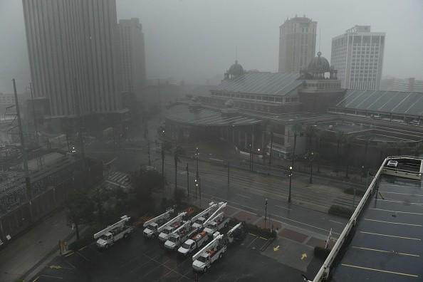
From Wednesday until Wednesday evening, AccuWeather's weather outlook showed that torrential downpours, hail and isolated tornadoes could emerge, affecting New Orleans, Mobile and Jackson residents.
- The forecast added that potential tornadoes could emerge in Mississippi, the western Florida panhandle, southeastern Louisiana and Alabama.
Significant rain with potential local flash floods
On the other hand, the weather could be challenging, extending until the Southeast and East Coasts.
As many residents think about the holiday rush, weekday shopping could be disrupted due to slowed commutes and travel hazards.
AccuWeather's report said significant rainfall could unfold from Tuesday until Thursday, causing travel delays and local flash flooding. However, the forecast noted that the rain could benefit drought-stricken areas.
- Significant rainfall could unload in Nashville, Little Rock, Atlanta, Baton Rouge and Mobile.
- In addition, the forecast said that rainfall reaching from one to two inches could fall in Carolinas, Georgia, Louisiana and Arkansas.
Meanwhile, the rain benefited drought areas, especially in Mississippi, Georgia and Alabama.
Related Article : Snow and Chilly Conditions Continue to Persist in Portions of Northeast
For more similar stories, don't forget to follow Nature News.
© 2026 NatureWorldNews.com All rights reserved. Do not reproduce without permission.


