A heavy rain warning and a heavy rain watch have been issued by New Zealand's Met Service this week.
A weather disturbance in the form of a tropical low-pressure system is causing the lurking weather threat.
There were no immediate reports of evacuations.
However, the situation in the coming hours or days could change drastically.
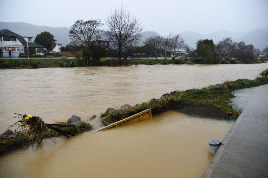
In August, New Zealand experienced a similar weather event wherein torrential rain and floodwaters forced the evacuation of hundreds of people.
It also prompted local authorities to issue a state of emergency for flood-ravaged areas, especially in South Island's Nelson city and some towns in North Island, where floods swamped homes and roads.
Met Service Weather Forecast
The Met Service on Monday, November 28, has issued severe weather warnings as heavy rain is expected to bombard the western parts of New Zealand on Tuesday and Wednesday, November 29 and November 30, resulting in potential flash flooding.
The weather forecast highlights a disturbed northwest flow that will spread into the country in the coming days, causing torrential in in western areas.
A heavy rain warning is in effect for Westland, while heavy rain watches are in place for northern Fiordland, northwest Tasman, and Mount Taranaki.
Orange Heavy Rain Warning
The Met Service posted an orange heavy rain warning for Westland, south of Harihari from 4:00 a.m. local time on Tuesday to 4:00 a.m. on Wednesday, November 30.
The warning means that heavy showers may cause rivers and streams to rise rapidly, a phenomenon also known as riverine flooding.
There is also the possibility of surface flooding and slips, as well as hazardous driving conditions.
The weather forecast suggests that 140 to 180 millimeters of rain is expected in a vast area, while 80 to 120 mm. of rain are anticipated in areas nearer to the coast. Peak rates of 15 to 25 mm. per hour about the ranges.
Heavy Rain Watch
The New Zealand weather agency also issued a heavy rain watch for Mount Taranaki from 9:00 p.m. on Tuesday to 6:00 a.m. on Wednesday.
Its forecast showed there will be periods of heavy rain with rainfall amounts reaching warning criteria.
The heavy rain watch is also in place for Tasman, west of Motueka, from 7:00 p.m. on Tuesday, November 29, to 1:00 a.m. on Wednesday, November 30.
The forecast suggested there will be a period of heavy rain with total amounts can near warning criteria.
Lastly watch is in effect in Fiordland, north of Doubtful Sound where 12-hour period from 2:00 p.m. on Tuesday to 2:00 p.m. on Wednesday.
The forecast also hints of heavy showers with rainfall amounts that could reach warning criteria.
Lower Pressure System
The cause of the looming wet weather is a low pressure system coming from the west and moving across New Zealand, according to the Met Service, as cited by Newshub New Zealand.
The system will cause the inclement weather to hang around as New Zealand waits for the summer season to start.
However, the New Zealand weather authorities expect the adverse weather to settle down towards the end of the week, particularly when the high-pressure system takes its place.
© 2026 NatureWorldNews.com All rights reserved. Do not reproduce without permission.


