Yellow thunderstorm warnings were issued for London and other areas across the country, including the southeast, the east of England, and the east Midlands until 3:00 p.m. on Thursday, August 25.
The storm alerts were issued by the Met Office as torrential rain battered parts of the UK in recent days.
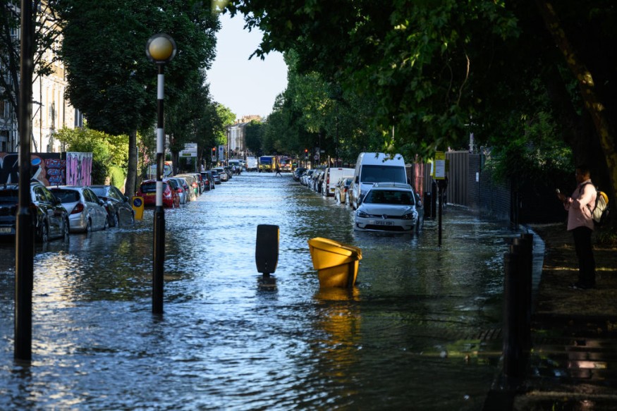
The heavy downpour caused flooding in some areas as several inches of rainfall were record in a short time period.
The warnings also encompass the risk of lightning strikes and hail, causing potential disruption to road traffic movement and train services.
Damage to infrastructure is also possible, including downed power lines which may result in power outages.
Delays, diversions, or cancellations of both domestic and international flights at London are also possible in the next hours and days.
The inclement weather occurred following several weeks and months of drought and extreme heat, which also impacted not only the UK but also Europe and the Northern Hemisphere.
While the torrential downpour is expected to compensate the lack of rainfall in the UK recently, the remainder of August could still reportedly see the persistence of a dry spell and hot weather.
UK Torrential Rain
Following the recent torrential rain, the Environmental Agency issued six alerts for areas susceptible to potential flooding, according to The Guardian.
Weather forecasters reportedly predict flooding to be likely due to "intense downpours," warning that 1.97 inches (50 millimeters) of rainfall could transpire in a short span of time in some areas, including Essex.
On Thursday, the Andrews field site in Essex recorded 36.5 mm. of rain during the early morning as heavy showers and thunderstorms passed through the east and southeast portions of England.
In east London, flash flood due to heavy rain led to the closure of the Dagenham Heathway station. A number of exits were also closed at the Charing Cross station in central London.
Met Office Forecast
In its short-range forecast on Thursday, the Met Office said a combination of wet and dry weather will affect some parts of the UK until Monday, August 29.
On Friday, August 26, the UK weather agency says cloud and rain will gradually move from the western regions in the east, becoming more showery throughout the day.
The case will be different for the central, eastern, and northwest Scotland, which will experience a dry weather.
For over a week, flash floods and thunderstorms struck some areas of southern England, causing widespread floodwaters in large areas of central London.
Similar thick rainfall was reported in High Beech, Essex, and Frittenden, Kent, the BBC reported.
Last week's flooding was triggered by torrential rain, which inundated roads across England, Scotland, and Wales but served as a form of relief to weeks of extreme heat and tinder-dry conditions, according to the UK media agency.
The UK is currently in its summer season, which spans from June to August each year.
During this year, the country witnessed above-average temperatures caused by heat waves of heat domes.
© 2026 NatureWorldNews.com All rights reserved. Do not reproduce without permission.


