Heavy rain will elevate a flash flood risk stretching across a 1,200-mile zone from Kansas to West Virginia this week.
This is according to AccuWeather meteorologists, who warned that while the torrential rain could bring drought and heat relief, it will be replaced by dangerous flash flooding risk.
These weather hazards could happen starting Tuesday, July 26.
The wet weather, which will also reach as far as Tennessee and Virginia, is triggered by a northern edge of extreme heat and a more temperate air.
The said meteorologists called this as a "weather battle zone," which was seen multiple times in previous weather forecasts and reports by US weather authorities in the past.
The looming inclement weather will significantly cut high temperatures, which spiked last week for regions affected by the heat wave or heat dome ravaging across the United States.
The forecast also warned that such heavy downpours could slow travel and put urban areas at risk from flash flooding, especially those situated near small streams.
Rainfall-triggering hot weather have been a common occurrence in the US, which is currently in its summer season that spans from June to September.
In recent weeks, multiple weather reports indicated an exchange of various weather events in different regions, including severe weather, wet weather, and heat wave, as well as the monsoonal moisture in the Southwest US.
1,200-Mile Heavy Rain
Storms from the central Plains to the southern Appalachians and the Northeast US will push heat away this week, according to AccuWeather Meteorologist Matt Benz.
With this, temperatures will be slashed by approximately 10 to 20 degrees.
This comes after the high temperatures ranging between 90 degrees to nearly 100 degrees Fahrenheit last week until the recent weekend.
As a result, the following cities and its surrounding areas could see temperatures in the upper 70s to the low 90s this week:
- St. Louis, Missouri
- Kansas City, Missouri
- Roanoke, Virginia
- Richmond, Virginia
Wet Weather Forecast
The temperature decline is being caused by a persistent weather system, which is pushing the heat dome farther south, leading to prolonged rainfall event and increased flash flooding risk, according to Joe Bauer, a senior storm warning meteorologist at AccuWeather.
The AccuWeather forecast is also in line with the outlook of the National Weather Service (NWS), whose Weather Prediction Center (WPC) on Monday, July 25, forecasted that a stormy and wet weather pattern will impact areas from the Middle Mississippi Valley to the central Appalachians.
What are Flash Floods?
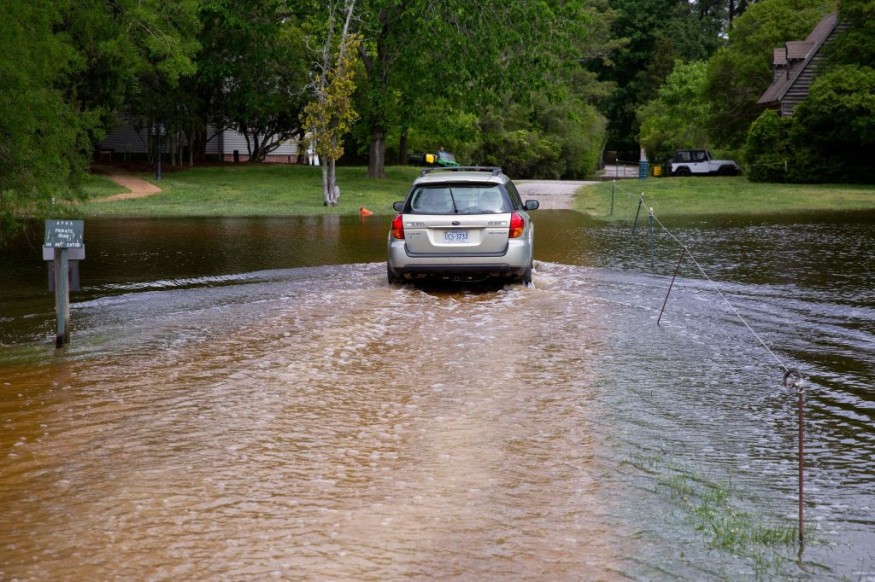
As mentioned earlier, the latest wet weather advisory indicates flash floods to be the greatest risk.
According to the United States Geological Survey (USGS), a flash flood transpires when runoff from excessive rainfall yield to a quick rise in the water level of a body of water, notably a stream or normally-dry channel.
Virginia is included again in the looming threat, based on the said forecasts.
This comes almost two weeks after 44 people went missing but were later found in the state following a massive flooding, according to CNN.
© 2026 NatureWorldNews.com All rights reserved. Do not reproduce without permission.


