Significant cooling is expected to replace the extreme heat in the Southwest. Early this week, temperatures in the southwestern United States might plummet by as much as 40 degrees Fahrenheit as a new weather trend pushes away the region's extreme, record-setting heat.
Temperature Change
After record-breaking heat last week and over the weekend over much of the Southwest, those looking for relief will be lucky to begin this week. According to AccuWeather projections, some regions might see a temperature drop of more than 40 degrees Fahrenheit on Monday compared to weekend highs.
Temperatures in numerous cities across the Southwest rose to levels that shattered daily record highs this past weekend. From Friday to Sunday, the temperature in Palm Springs, California, reached 110 degrees. The heat reached its height on Saturday, with a temperature of 114 degrees F, tying the previous records established in 1940 and 2019. Further north, Fresno, California, hit 103 degrees on Saturday, 13 degrees above the typical high of 90 degrees for the date.
From Friday through Sunday, Phoenix established new daily records on three consecutive days, with temperatures reaching just shy of 115 F each afternoon.
Meanwhile, Death Valley, California, saw the highest temperatures, as is typical. On Friday, the temperature reached an incredible 123 degrees Fahrenheit, followed by a 122-degree measurement on Saturday, both of which were new daily highs. In mid-June, the average high temperature in Death Valley is 110 degrees Fahrenheit.
A cold front moving eastward across the region will aid in forming a dip in the jet stream over the area. While the eastern two-thirds of the United States will see excessive heat and violent thunderstorms, colder air will settle over most of the West. Highs may be nearly 10 degrees below normal in several places west of the Rockies.
"As the heart of the high heat shifts into the central United States, there will be a chance for cooler air to sneak into the West," AccuWeather Meteorologist Lauren Hyde noted. "The cooling will not be permanent, but it will provide a welcome relief from the tremendous heat of last week."
Temperatures are only predicted to reach the upper 60s on Monday in Salt Lake City, Utah, after Sunday's high of 102 F beat the day record established in 1918. The city's average high temperature is 83 degrees.
Closer to the West Coast, temperatures in Sacramento, California, will be below normal after reaching triple digits on Friday. On Monday, the city will have a high of 85 degrees.
Cloud Formations
With continuous cloud cover and intervals of light rain over the Pacific Northwest, it may feel downright cold to start the week.
Despite the calendar, some mountain snow is conceivable, although any accumulation will be well above the pass level. In parts of northern Montana, a Winter Storm Warning has been issued, with up to 2 feet of snow possibly above 7,000 feet.
Despite an average high of 73 degrees in Portland, Oregon, where the chill has already begun, temperatures only reached 61 degrees on Sunday. Similar temperatures are projected for the city through Wednesday, with highs in the lower 60s expected each day.
As the city avoids rains, temperatures in Seattle are expected to linger around 60 degrees on Monday. The city has seen measurable rain for five days in a row, while highs in the city failed to exceed 60 degrees on Sunday.
While warmer weather is expected to return on Tuesday and Wednesday, afternoon temperatures will remain close to normal for mid-June rather than reaching record highs. Highs in the upper 80s to low 90s are expected over California's Central Valley, which is about usual for this time of year.
Moisture Surge
A surge of moisture further east will aid in the start of the monsoon season in portions of the Southwest. Late this week and into the weekend, a rise in humidity will assist in spawning some showers and thunderstorms, which may help alleviate the continuing drought and wildfire situation.
"While the cold front's strong winds will continue to stoke wildfire flames, a burst of monsoonal precipitation might assist deliver much-needed dousing of the flames," Hyde said.
"Some places may face flooding," said AccuWeather Senior Meteorologist Joseph Bauer. "This is especially true in areas with recent burn scars." "In and near these places, mudslides and debris flows are possible."
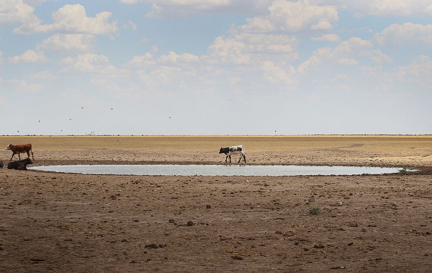
Dealing with Droughts
According to the United States Drought Monitor, the whole state of New Mexico is suffering significant drought, with almost half of the state experiencing exceptional drought, the worst and most severe type of drought. While a significant quantity of rain is required to close the gap, the return of monsoonal precipitation may offer the initial steps.
Related Article : Record Breaking Freeze Hits Australia as Experts Recorded the Coldest Start of Winter for Over a Century
For more environmental news updates, don't forget to follow Nature World News!
© 2026 NatureWorldNews.com All rights reserved. Do not reproduce without permission.


