As extreme weather records drop and snow falls on beaches, an Australian city is shivering through its coldest start to winter since 1904. and it's far from over
Australia's severe deep freeze sends records tumbling; Brisbane will freeze through its coldest start to winter in more than a century.
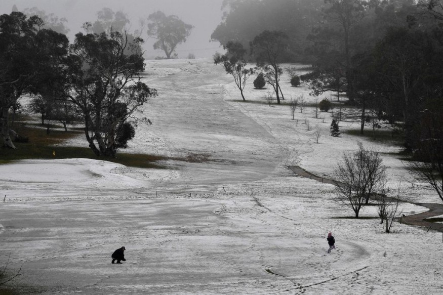
Freezing Temperatures
Forecast temperatures in every major city save Perth will plunge to levels not seen in decades due to an icy arctic blast.
The last time Sydney was this cold was in 1989, when Bob Hawke was in power, while Brisbane braced for its worst cold spell since 1904.
Melbourne hasn't been this cold since the South Melbourne Swans AFL club relocated to Sydney in 1982.
There's no escape in the tropical Top End, with Darwin and Cairns expected to be substantially colder than average this week and blizzards possible on Tasmania's beaches.
With the best start to the season in years and more snow on the way, courtesy of a freezing Antarctic ice storm, the history books are being rewritten on the snowfields.
Also Read : Atlantic Hurricane Season to Begin in Early June
Heavy Snowfall
Mount Hotham and Falls Creek both received about a meter of snow, Mount Buller's 73cm is the greatest in more than two decades, and NSW resorts are expected to get the most snow since 1968.
A high pressure system has formed south of Adelaide, blasting frigid winds straight at Australia from the South Pole.
Brisbane is projected to reach 6 degrees Celsius on Friday, with Sydney dropping to 7 degrees Celsius, the lowest in 33 years.
Brisbane is expected to shiver for the remainder of the week, with lows of 6 to 8 degrees Celsius, the lowest it has been this early in June since 1904, 118 years ago.
The wind chill will make the record lows considerably colder, with the 7C at Brisbane Airport at 5:40 am on Wednesday feeling like just 2.1C.
According to the weather service, Toowoomba was a pleasant 8.8 degrees on paper, but it felt like 1.2 degrees with the wind.
It will eventually warm up to 9 degrees Celsius on Sunday and stay there until next Wednesday.
Hobart will drop to 2 degrees Celsius on Saturday, with snow forecast for the Apple Isle's southern beaches.
These factors will mix with a cold, dry influx of air, resulting in frigid temperatures through next weekend.
On Tuesday next week, Melbourne is expected to reach 6 degrees, while Canberra will experience a cold -4 degrees.
Lingering Cold
Ice conditions are expected to linger until next weekend because the low-pressure system bringing the frigid winds is slow moving. Icy conditions are expected to linger until next weekend.
According to Weatherzone forecaster Chris Matthews, Sydney residents are in for a chilly week, with the highest temperature expected to be 17 degrees Celsius.
'Because of the wind chill effect, this week will seem significantly colder,' he told Daily Mail Australia.
In addition to the bitter cold, rain is forecast for portions of NSW, Victoria, the ACT, and South Australia during the next several days.
Rain showers are forecasted in Adelaide over the next several days, but it is expected to dry out by Sunday. Thunderstorms are expected in sections of NSW's southern slopes and Riverina.
Melbourne is also expecting storms, but Sydney is expecting a dry week.
For more environmental news updates, don't forget to follow Nature World News!
© 2026 NatureWorldNews.com All rights reserved. Do not reproduce without permission.


