Evacuation alerts have been issued for 100 properties within the Six Mile community around the Duhamel Creek in British Columbia, Canada, as of 7:00 p.m. local time on Sunday, June 12.
The alert was imposed due to possible flooding from water levels of the creek in Electoral Area F.
The evacuation alert is not mandatory, according to the Regional District of Central Kootenay (RDCK). However, the authorities have warned residents to be prepared to leave at any time and remain vigilant.
In addition, the disaster preparedness agency recommended people to prepare emergency kits, as well as to be ready to move not only their important belongings but also pets and livestock into a safe area.
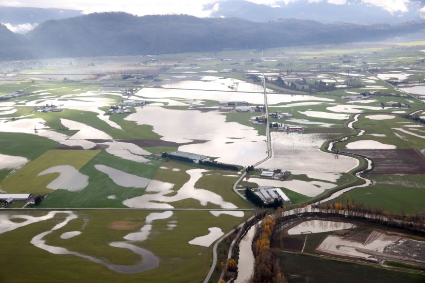
Since May, the B.C. River Forecast Centre (RFC) has expressed great concern regarding the growing flood risk across the province.
The threat emanates from the delayed melting of mountain snowpack and ice in different areas of B.C.
The reality of the risk became more concrete as the B.C. centre reported in the onset of June that the snowpack level has significantly increased.
As Canada enters its summer season, extreme heat or rainfall could simultaneously melt the frozen waters, leading to large-scale flooding.
Evacuation Alert
The RDCK's Emergency Operation Centre reminded not only residents but also visitors that an evacuation order will be imposed should the situation worsens, as cited by Global News.
This comes as the B.C. RFC issued a "High Streamflow Advisory" for the West Kootenay area, which means the river levels are starting to rise or are expected to rise quickly, which could eventually surpass the river banks.
With this, the RDCK, warned the public to avoid going near the edges of watercourses, and are urged to report any incident of erosion or flooding to the Provincial Emergency Coordinator Centre.
B.C. Flood Risk
The supposed melting of the snow and ice in B.C. back in the spring from March to May could have alleviated the flood risk in the province.
However, meteorologists and hydrologists have been on high alert as the delay could trigger a looming catastrophic natural disaster.
The ongoing High Streamflow Advisory in the area is part of a three-tier scale for advisory and warning levels being issued by the B.C. RFC, which are as follows:
- High Streamflow Advisory: the lowest category of all the levels that indicate no major flooding is expected but minor flooding is possible in low-lying areas
- Flood Watch: flooding is likely as river levels start to rise or could breach the banks, causing floodwaters to affect adjacent areas
- Flood Warning: the highest category where river level has exceeded the bank already or is imminent, which can definitely flood areas next to rivers
On June 1, the centre already reported the snowpack accumulation was already beyond normal levels, which has increased by 165% across the province.
The Kootenays area is one of the many locations that the B.C. RFC highlighted to be at most risk.
In the coming days and weeks, flood-related alerts or warnings are expected to be issued in different parts of B.C.
© 2026 NatureWorldNews.com All rights reserved. Do not reproduce without permission.


