Severe thunderstorms are expected once again over the Great Plains and the Mississippi Valley this week, according to US weather authorities.
Flooding due to heavy rain and other weather hazards is likely during the severe weather in the coming hours and days.
The latest US government weather forecast comes as the country experienced not only related weather events over recent months but also ongoing wildfires in southwestern states since April.
These incidents became prevalent this year since the start of the US spring season on March 20.
US Weather Forecast
The Weather Prediction Center (WPC) of the National Oceanic and Atmospheric Administration (NOAA) - National Weather Service (NWS) on Tuesday, May 3, issued its latest US weather forecast.
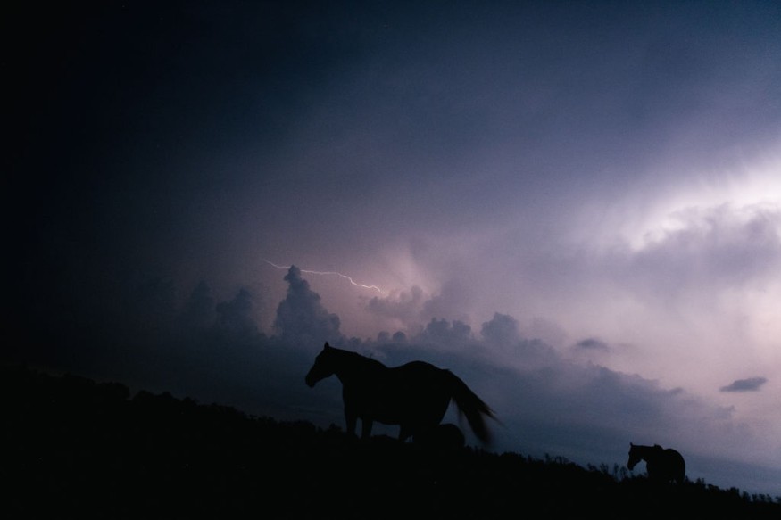
This time it includes the risk of damaging winds, hail, heavy rainfall, and tornadoes as part of thunderstorm warnings.
In addition, the WPC's short-range forecast suggested that excessive rainfall with a rate of at least two inches per hour can result in flash flooding across the Central US and Southern US.
The new weather forecast will be valid from Wednesday to Friday, May 4 to May 6.
During this period, life-threatening risks and widespread disruption are possible. Disruptions, such as delayed or halted public transport and flights, as well as power outages are likely.
Low Pressure and Thunderstorms
A weather disturbance in the form of a low-pressure system has been forecasted to be responsible for the upcoming severe weather.
The weather pattern will move from the Rocky Mountains to the Appalachians until Thursday, May 5.
Based on the said forecast, the system emerges from the southern High Plains by Wednesday afternoon and heads towards Missouri later on Thursday.
As a result, flash floods are possible as rainfall accumulation between three to five inches is expected by Thursday evening, said the NOAA - NWS.
Furthermore, this storm system will also be accompanied by severe thunderstorms in the same general area, notably in the warm sector of the low-pressure system.
The US weather agency mentioned an Enhanced Risk of severe thunderstorms across the Central Great Plains, which includes the states of Kansas, Nebraska, Oklahoma, and Texas.
In Kansas, a previous thunderstorm last week resulted in the occurrence of a tornado in Andover, injuring four people and causing severe property damage.
Meanwhile, three meteorology students from the University of Oklahoma, after their storm-chasing trip in Kansas, died in a car crash after a different tornado passed over a highway in the Herington area, as per the BBC.
Other Weather Forecast
Furthermore, the NOAA also cited a forecast from its Storm Prediction Center (SPC) regarding fire weather in the Southwest US.
The agency also indicated there could be showers and high elevation snow in the Pacific Northwest on Thursday, as a Pacific storm system enters the region.
In another forecast, the NOAA - NWS said critical fire weather conditions may continue in some areas of the Southwest US and the southern Rockies until Wednesday.
These meteorological conditions, such as relative humidity, soil moisture, dry fuel, and hot temperatures may favor fire growth.
The fire weather warnings will affect the state of New Mexico, where the Calf Canyon Fire is ongoing and a large-scale evacuation has been placed.
Other states such as some parts of Arizona and western Texas will also face the risk of renewed wildfires due to the said climatic conditions.
© 2026 NatureWorldNews.com All rights reserved. Do not reproduce without permission.


