Wildfires pose a threat once again to the Southwest US as weather authorities issued a new fire weather warning in the Rockies and its surrounding areas.
In Texas, three separate wildfires have erupted over recent days, which highlights the risk of similar natural events in other areas across the region.
Fire Weather Warning
The National Oceanic and Atmospheric Administration (NOAA) - Storm Prediction Center (SPC) issued a fire weather warning for some portions of the Southwest US, including the central-southern Rockies, and the High Plains.
This is due to increased surface winds combined with dry fuels that enhance fire weather conditions.
However, the intensity such as low, moderate, and critical will depend on other various factors such as humidity, soil moisture, and precipitation.
Under the warning, critical fire weather conditions will affect the area from eastern Wyoming, to western Nebraska, and southwestern South Dakota on Tuesday, April 19.
The said geo-climatic conditions that promote the growth and spread of wildfires will continue until Wednesday, April 20.
This came after the NOAA - SPC found that there is a lack of precipitation in the region over the past week, leaving only intensified dry weather and windy conditions.
The US agency added that over 20 miles per hour (mph) of winds and grass-based fuels may aggravate wildfire until Tuesday morning or afternoon.
The areas between southern New Mexico, northern Arizona, and southern Nevada are also critical highlights for the risk of wildfires.
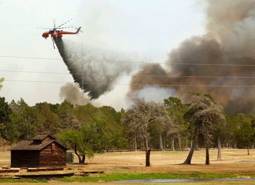
Texas Wildfires
A total of three wildfires broke out in the Haskell, Nolan, and Taylor counties of the Abilene area of Texas on Easter Sunday, April 17.
The separate fires engulfed a combined land area of 2,000 acres, according to a spokesman of the Texas A&M Forest Service, as cited by the Abilene Reporter News.
The latest reports as of the morning of Monday, April 18, suggest there were no immediate indications of casualties or infrastructural damage.
Below are the following name and locations of each wildfire in the state:
- Easter Blues Fire - this wildfire in Abilene near FM 89 road and a few miles west of Highway 277 had a containment rate of 0% and covered an area of 200 acres, prompting ground fire crews to douse the blaze.
- Nina Lucia Fire - the Forest Service on Monday evening responded with aircraft and ground equipment to tackle this 200-acre to 500-acre fire with 25% containment west of FM 1170 road in the southwest portion of Nolan County.
- Stag Fire - emergency responders were also occupied extinguishing this wildfire in southern Haskell County, located west of FM 600 road and south of Lake Stamford.
Increasing Wildfire Risks
According to the Center for Climate and Energy Solutions (C2ES), the increased coverage and intensified strength of wildfires in the Western United States are significantly caused by climate change.
Since climate change in contemporary times has contributed to the rising global temperatures, a chain-effect of geological and climatic conditions, including dry and hot weather, has elevated not only the frequency of forest fires or bush fires but also natural hazards such as drought and extreme weather.
Between 1984 and 2015, the number of large fires in the said US region have doubled, says the C2ES.
© 2026 NatureWorldNews.com All rights reserved. Do not reproduce without permission.


