Cyclone Fili is approaching New Zealand and is expected to make landfall on North Island on Tuesday, April 12.
Meteorological authorities in the country issued several storm warnings for heavy rain and severe gales. Storm-force winds also pose a threat to coastal areas as the storm will likely intensify.
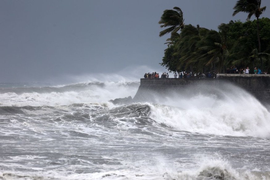
Cyclone Fili
Met Service weather forecaster Raveen Das told Morning Report that several coastal areas may receive at least 100 mm. of rainfall in 24 hours, as cited by Radio New Zealand.
This is possible as Cyclone Fili is moving in a southeastward pattern over the South Pacific Ocean from New Caledonia.
In addition, Met Service meteorologist David Miller stated that the chance of Fili hitting the South Pacific country from Tuesday to Thursday, April 14 is growing, as per Stuff.co.nz news.
Miller added that Cyclone Fili may bring uncertainty on its path in the coming days.
Regardless, North Island is still likely to be hit by the storm, says Miller.
Devastation in New Caledonia
Last week, Fili formed as a tropical cyclone near New Caledonia and was initially forecasted to reach Category 2 or even severe Category 3 in strength, according to Weather Watch, as cited by The New Zealand Herald.
Cyclone Fili brought massive flash floods and caused blackouts in New Caledonia in recent days.
The main road connecting the main island to the northern and southern regions was submerged in flood. More than 3,000 houses were left without electricity.
This prompted the elevation of rescue alert levels for 16 districts in the northern territory.
Storm Warning
After leaving New Caledonia and passing through its capital Nouméa, the weakened state of Cyclone Fili has still raised concerns about its potential damage and disruption in New Zealand, especially in the Tairāwhiti Gisborne, which was recently hit by major flooding due to torrential rain.
As other areas are at risk, local authorities issued rain warning notices in the Coromandel Peninsula, the Bay of Plenty and Rotorua, Gisborne, and Hawke's Bay in North Island, as per New Zealand's 1 News.
Large waves pose the greatest threat in these locations.
In addition, strong wind warnings have been issued for Auckland, Great Barrier Island, the Coromandel, and Gisborne. From Monday, April 11, a front is reportedly expected to bring heavy rainfall in Fiordland and Westland.
Potential Disruption
Furthermore, Fili is expected to cause a storm surge in coastal areas, causing inland flooding. Maritime services surrounding the North Island are also likely to be disrupted.
Gusty winds and the heavy downpour of rain may also cause some possible delays, cancellations, or diversions of domestic flights and international flights across New Zealand, including at the Auckland Airport on North Island.
Cyclone Season
The formation of storms in the Pacific Ocean are common. In the South Pacific, several tropical cyclones hit New Zealand approximately between November and April each year.
These weather events are also associated with thunderstorms but tornado outbreaks in the country are reportedly rare.
The worst storm in New Zealand occurred in 1968 when Cyclone Giselle caused widespread flooding and damage, killing more than 50 people.
© 2026 NatureWorldNews.com All rights reserved. Do not reproduce without permission.


