The tropical low has been initially forecasted earlier to develop into a cyclone and hit the coast of Queensland, Australia, this week as it navigates the Coral Sea.
However, the potential tropical cyclone is unlikely to make landfall in Australia's northeastern state.
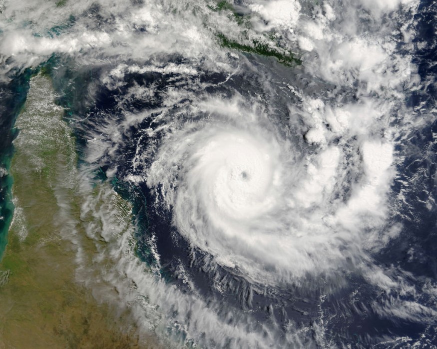
Tropical Low and Current Forecast
Meteorologists from multiple countries in Oceanica are reportedly monitoring the tropical low that has been sitting in the Coral Sea for several days.
It has passed through the Solomon Islands and is currently west of Vanuatu.
The system is considered to be a low-pressure tropical depression, which is currently under the jurisdiction of Fiji.
The Fiji Meteorological Service stated there is a high probability that the low will develop into a cyclone after 36 hours, as per the news site Tropic Now on Monday, April 4.
This means that the tropical depression can turn into a tropical cyclone in the Coral Sea as early as Wednesday, April 6.
Although the tropical low is moving in a westward pattern, it is only expected to cause large ocean waves or ocean swells in the coastal areas of Queensland.
The said tropical depression is moving slowly at the moment. It will continue to move south-westward and eventually in a southeastern pattern once it becomes a tropical cyclone from mid-week, according to weather forecaster Steve Hadley, as cited by Tropic Now.
Furthermore, the Bureau of Meteorology (BOM) said the system is unlikely to come near Queensland as previously forecasted.
Previous Forecast
The BOM issued a previous weather forecast on Saturday, April 2, that the tropical low has between a 5% and 20% chance of turning into a cyclone.
The Australian weather agency also issued a tropical cyclone warning for Queensland during that time, as per 9 News Australia.
Due to the latest weather forecasts, the system will likely cause an immediate impact on Fiji, Vanuatu, and its surrounding countries rather than on Queensland alone.
However, the low still poses a threat to communities in coastal Queensland.
Regardless of the latest developments, the intensity and pattern of the system can change at any time, resulting in the continuance of updated weather forecasts and weather advisories.
Potential Storm Hazards
Upon intensifying into a tropical cyclone, the low-pressure depression can bring heavy rain, causing widespread flooding in Fiji, Vanuatu, and some coastal parts of Queensland.
A strong wind gust of the cyclone can also cause not only ocean swells but also a storm surge.
According to the National Oceanic and Atmospheric Administration (NOAA) - National Ocean Service (NOS), a storm surge is an anomaly or an abnormal rise in sea or ocean level during a storm.
This is primarily caused by strong winds from the storm pushing water into the shore.
The NOAA - NOS emphasized that the winds generate large waves that affect coastal areas.
Second System
While the tropical low continues to traverse the region, a separate system is being monitored by the BOM, and it could form in the Solomon Sea and move southward during the week.
The said system is purportedly not likely to develop into a tropical cyclone.
© 2026 NatureWorldNews.com All rights reserved. Do not reproduce without permission.


