From Florida to New York, severe weather will endanger nearly 30 million people on Saturday, with hail, isolated tornadoes, heavy downpours, and devastating wind gusts all conceivable.
Expecting a Powerful Storm
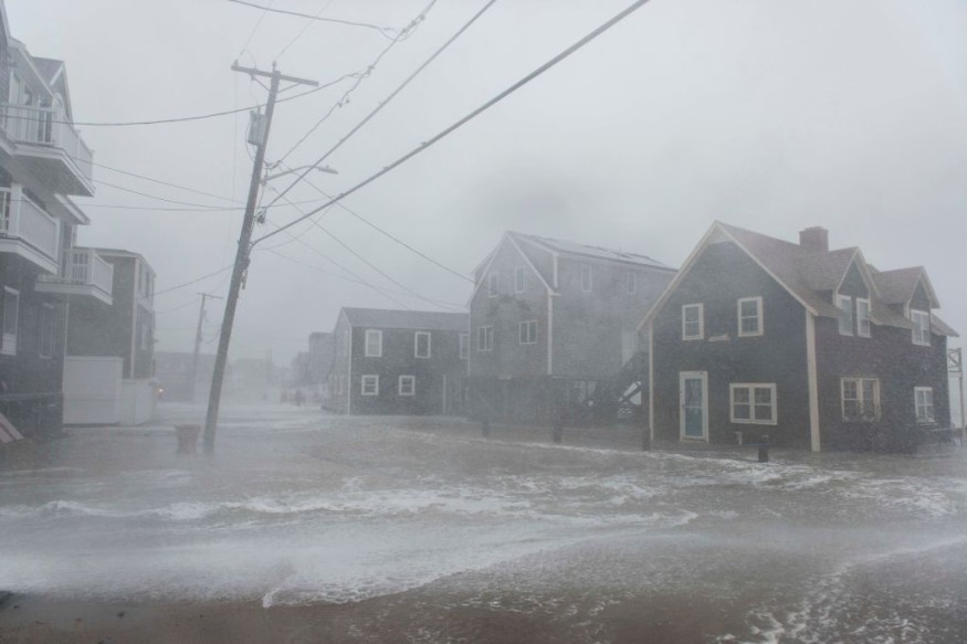
A powerful storm is expected to cause catastrophic weather in the eastern United States after tornadoes ripped across areas of the Tennessee and Ohio valleys and the South on Friday.
Saturday will most likely be a busy weather day, as AccuWeather Meteorologist Brandon Buckingham noted that they would be watching the danger of thunderstorms throughout the afternoon.
There will be two zones of possibly severe weather over the East, with coastal towns such as Savannah, Georgia, Myrtle Beach, Charleston, South Carolina, and Wilmington, North Carolina, in the southern section. Only locally severe storms are expected in this part of the Southeast, while every thunderstorm that passes through might create a short rain and cause traffic delays. There's also a chance of an isolated tornado or two from Florida to southern Maryland and Delaware.
With a strength of 75 mph, hail, isolated tornadoes, severe wind gusts, and heavy downpours causing limited visibility are expected. Travelers on key interstates such as Routes 76, 80, 81, 90, and 95 may expect delays from unexpected bursts of severe weather. If heavy weather strikes, motorists are advised not to go across flooded streets and slow down and pull over.
Forecast
According to the forecast, thunderstorms are expected to start between 2 and 4 p.m. Buckingham stated that he would be in central Pennsylvania and upstate New York.
The storm will arrive in the afternoon from State College, Pennsylvania, to Syracuse, New York, with locations further east waiting a little longer.
Storms are expected to move eastward into the early evening hours, bringing the risk of gusty winds, hail, and possibly an isolated tornado to places like Binghamton, New York, Scranton, and Allentown, Pennsylvania, as well as further South and East into Philadelphia and New Jersey, according to Buckingham.
BIG STORM
This extreme weather will be accompanied by a bigger storm that has brought snow to the Plains and Great Lakes and severe weather to the Ohio Valley and southern states.
An area of low pressure and its associated cold front will move eastward over the Ohio Valley and Northeast through the evening hours of Saturday night, posing a concern, according to Buckingham.
What Comes Next
After the strong storms pass through on Saturday night, Sunday looks to be colder and windier. Although temperatures in most parts of the Northeast reached the 70s on Friday, projected highs in the 40s and 50s may cause a shiver.
While some showers and snow are possible in the inner Northeast, the rest of the Atlantic Coast is likely to be considerably drier as attention turns to the next major storm, which is expected to deliver potentially deadly severe weather to the South early in the usual workweek.
For more news about the environment, don't forget to follow Nature World News
© 2026 NatureWorldNews.com All rights reserved. Do not reproduce without permission.


