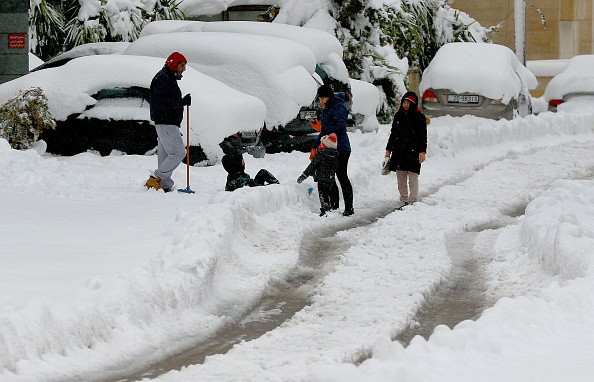
Meteorologists are watching the early stages of a large-scale, disruptive winter storm that is expected to bring plowable snow and substantial ice to areas of the Northeast this week.
Forecasters predict Denver, Dallas, and Detroit are among the big metro regions to see snowy conditions and possible travel disruptions, according to AccuWeather.
Freezing Groundhog Day
Around the time Punxsutawney Phil gives his widely anticipated forecast on Groundhog Day, winter and spring will be battling it out in the middle of the country. As a fresh wave of Arctic air dives southward into the northern Plains and warm, moist air from the Gulf of Mexico rushes northward, the battle of seasons will begin.
A 2,000-mile-long band of snow and ice is anticipated to break out as early as Tuesday night, reaching from parts of Colorado and New Mexico through Kansas, Oklahoma, Missouri, Illinois, Indiana, and Michigan. Wednesday night, the wintry risks are expected to spread further south and east into Texas, Arkansas, and parts of the lower Ohio Valley.
"Depending on the storm's precise trajectory, a protracted zone of icing may form from central Texas to the Ohio Valley, putting areas like Dallas, Little Rock, and Indianapolis under a substantial ice hazard around the middle of this week," said Meteorologist Joe Bauer to National Geographic.
Read also: Bomb Cyclone: Atmospheric Scientist Explains Everything You Need to Know About This Winter Storm
Freezing Conditions
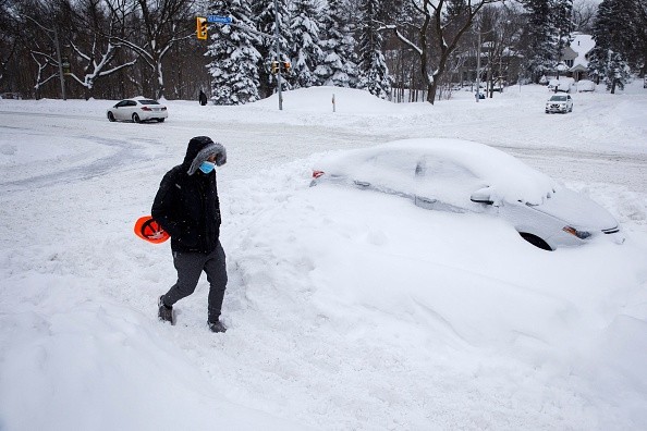
Regions that suffer considerable ice from this storm may experience felled trees and power lines. Authorities warned, noting that the storm's scope over such a vast area might exacerbate logistical issues.
The ice phase in some regions of this route might continue 12-24 hours or more.
Travel will become extremely difficult and risky, mainly when freezing rain is the predominant ice precipitation type. Freezing rain coats untreated roads and sidewalks in ice cling to trees and electrical wires, causing power outages.
A zone of accumulating, plowable snowfall will be located just to the north and west of the ice corridor.
Snowfall will be highest in the central and southern Rockies. However, experts warn that there will be enough snow to cause slick roads and delays to everyday activities even outside of the mountains.
"A band of heavy snow accumulating at rates of more than one inch per hour may stretch from eastern Kansas through central Illinois, northern Indiana, southeast Michigan, and northwest Ohio, with totals of more than six inches possible," Bauer warned.
Even parts of western Texas, such as Amarillo and Midland, and Oklahoma, including Oklahoma City, might be affected by the storm's wintry aspect when a sharp chill replaces the current warm weather.
According to Bauer, temperatures in the South Central states can drop 20 to 30 degrees in 24 hours.
Because of the mild weather in the area, any snow will melt quickly as it comes into touch with roadways and sidewalks. However, when the snow continues to fall and the temperature drops, the situation can quickly become slippery.
The southerly flow of cold air may be strong enough to bring snow and ice as far south as Texas' Big Bend late Wednesday and Thursday.
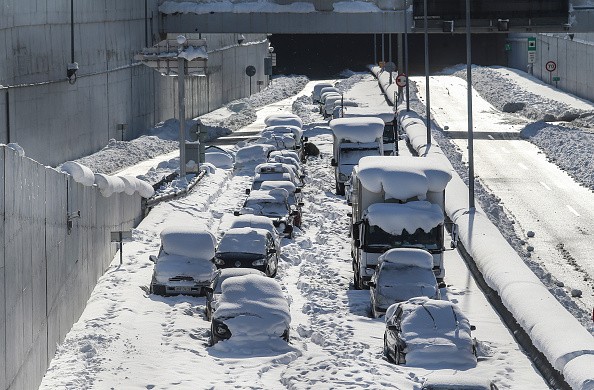
Travelers on the road and in the air may expect major delays due to the storm's broad breadth. Passengers with arrival and departure flights or connections in Denver, Dallas, St. Louis, Chicago, Detroit, and Indianapolis could expect delays around the middle of the week due to weather.
In 2011, a blizzard on Groundhog Day caused massive snowfall and traffic congestion in Chicago. According to experts, the Windy City may be on the verge of substantial snow accumulations with this storm.
Extreme Weather
Weather-related travel issues might directly affect some of the major Northeast hubs as the storm moves closer to the Eastern Seaboard later this week. Unlike the last bomb cyclone, which dropped feet of snow on the region, the incoming storm is forecast to offer a mixed bag of precipitation.
According to meteorologists, even tiny changes in the storm's route may have a big impact on precipitation types and whether a site is in the rain, persistent snow, major ice, or nuisance flurries and light snow corridor. A push of dry air behind the storm might also push the storm farther south than expected, resulting in reduced snowfall quantities on the northern and western edges of the precipitation.
Forecasters predict that the storm's effects will be more than simply wintry and that severe weather may also be a concern. Soaking rain and thunderstorms are anticipated to the south and east of the ice mix corridor.
"Heavy rain from eastern Texas to the Tennessee Valley and parts of the Southeast might cause flash floods and severe storms," Bauer added.
Meteorologists will continue to track the storm's progress in the following days and offer further information on precise timing, snowfall levels, and locations at risk of a severe ice storm.
For more news about the environment , don't forget to follow Nature World News!
© 2026 NatureWorldNews.com All rights reserved. Do not reproduce without permission.


