AccuWeather forecasts predict a few more drizzle of rain and a wintry mix to wash over the Northeast during the last days of 2021, although a weather system that began before Christmas is in no rush to end.
Storms Roaming Around
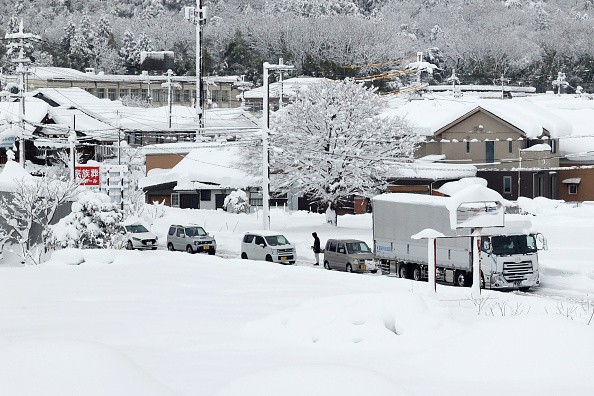
Storms have moved over the region like clockwork in recent days, arriving every 24 to 36 hours. They've dumped just enough snow and ice throughout the Northeast's interior to make travel treacherous.
These storms have been riding along the northern rim of a high-pressure system that has been anchored over the Southeast. According to Lead Long-Range Meteorologist Paul Pastelok, this high will continue firm over the Southeast, sending warmer air north in the upper layers of the atmosphere. At the same time, the area near the ground remains frigid.
"For many regions, this will result in a combination of freezing rain, sleet, snow, and rain," Pastelok added.
On Monday morning, the region's newest storm hit the middle Appalachians, sending snowflakes flying throughout western New York, central and southern Pennsylvania, and the northern suburbs of Baltimore.
Related Article : Intense Snowstorm Closed Down a 111-Mile Stretch of California Highway
Snow Covered Highway
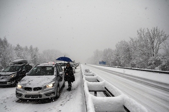
As cameras showed snow-covered highways, there were vehicle accidents along Interstate 80 in Pennsylvania. As the ground became covered in snow, speed limitations were implemented for parts of the route.
This round of precipitation arrived in New England Monday night and will continue through Tuesday, with heavy snowfall most probable in Maine. However, a dusting of snow or sleet is expected near and north of New York City for a while.
Tuesday afternoon, the next storm will arrive on the doorsteps of the mid-Atlantic states.
"A wintry mix throughout northern Pennsylvania and upstate New York is anticipated to provide additional slippery travel later Tuesday into Tuesday night," Senior Meteorologist John Feerick warned.
Motorists are urged to use caution on inner roads, particularly during the midnight and early-morning hours when it's more difficult to notice a covering of ice. When it comes to wintry weather, bridges and overpasses are usually the first to become frozen.
"The first inch or two of snow may be challenging to drive on and pose serious problems for motorists," said Senior Meteorologist Alex Sosnowski.
From around Interstate 80 to points north, meteorologists predict a dusting to an inch or two of snow before shifting to a wintry mix.
On Tuesday night, dry air over New England is predicted to limit the precipitation's northern and eastern extend into cities like Boston, Portland, and Bangor, Maine.
Challenging Travel
According to Feerick, treacherous travel in New England might migrate further north with the next storm, which is expected to hit Wednesday night into Thursday. Due to a stronger northward push of warmer air, the area of any snowy precipitation with the late-week event is predicted to be even less than the storms earlier in the week.
"There will only be modestly cold air in situ," Feerick said, "which should keep the majority of precipitation along the I-95 corridor in the form of rain with the storms this week."
Even with all wet roads, forecasters warn that traffic will be slower because of limited visibility.
On New Year's Eve, the region may be between storms as people fly to New York City and other large cities to ring in the new year. Still, meteorologists will be keeping a close check on a big storm anticipated to form over the country's middle. According to the latest forecasts, this storm will be the most powerful group, bringing rain, wind, snow, ice, and dramatically colder air to the Northeast in the opening days of 2022.
For more news about the environment , don't forget to follow Nature World News!
© 2026 NatureWorldNews.com All rights reserved. Do not reproduce without permission.


