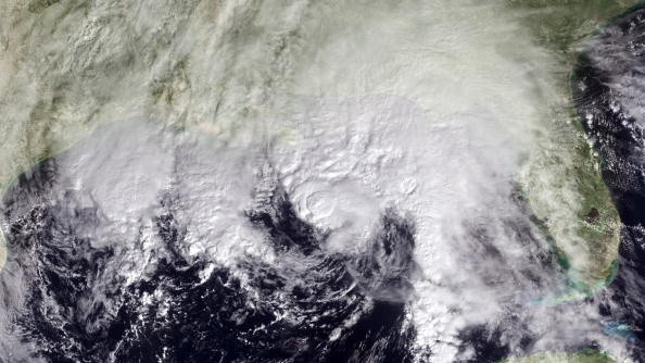
Tropical Storm Ida is moving very quickly toward the Gulf Coast, and before it gets to the region, it could possibly bring hurricane force along with it.
Currently, Ida is churning in the Caribbean with about 40 mph winds and there is a possibility of it reaching the US by Sunday, as per an update on Thursday evening from the National Hurricane Center. Some places could witness up to a foot of rain, and 11 feet of storm surge.
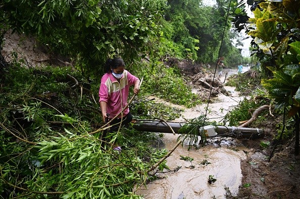
Residents in Louisiana are already bracing for the possible fallout. On Thursday, John Bel Edwards, the Governor, issued a state of emergency because of the possible impacts of the storm. He also mentioned that hurricane force winds of 110 mph were predicted.
Edwards said: "Unfortunately, all of Louisiana's coastline is currently in the forecast cone for Tropical Storm Ida. Now is the time for people to finalize their emergency game plan, which should take into account the ongoing COVID-19 pandemic."
Also Read : Meteorologists Monitor 3 Potential Atlantic Tropical Systems that Could Develop in Coming Days
Potential Flooding
Governor John Bel Edwards said everybody should be in the area they plan to ride the storm out by Saturday evening.
The governor added that while it is his hope and prayer that the storm will not lead to destruction in the state, residents should be ready to take the chief impact of the severe weather.
As per the NHC, a hurricane watch has been issued from Cameron, Louisiana, eastward to the border of Mississippi and Alabama, including New Orleans. But for now, a tropical storm watch is in effect in some portions of Mississippi, Alabama, and Florida.
When Ida reaches its destination, usually, rising waters propelling inland from the shoreline could flood dry regions close to the coast, the NHC said. That rise could attain up to 11 ft from Morgan City, Louisiana, to Ocean Springs, Mississippi.
Places under Tropical Storm Warnings
As early as Saturday, the Gulf Coast could witness hurricane-level winds and through Monday the region could witness 8 to12 inches of rain, the NHC said. But before the US gets to handle Ida, the Caribbean will have to encounter the storm.
First, tropical storm Ida is anticipated to move over the Cayman Islands, then have an effect on the Isle of Youth and western Cuba Friday.
Places under tropical storm warnings are the Cuban provinces of Matanzas, Mayabeque, Pinar del Rio, Artemisa, Havana, and the Isle of Youth, as well as the Cayman Islands. There, the storm finds its way into the Gulf of Mexico.
The NHC said: "Once the system moves into the Gulf of Mexico, conditions are expected to be conducive for additional strengthening, and rapid intensification is explicitly shown in the NHC forecast between 48 and 72 hours."
The intensity forecast of NHC takes the system close to the main hurricane strength when it gets nearer to the northern Gulf Coast on Sunday, the NHC added.
For more news, updates about Tropical Storm Ida and similar topics don't forget to follow Nature World News!
© 2026 NatureWorldNews.com All rights reserved. Do not reproduce without permission.


