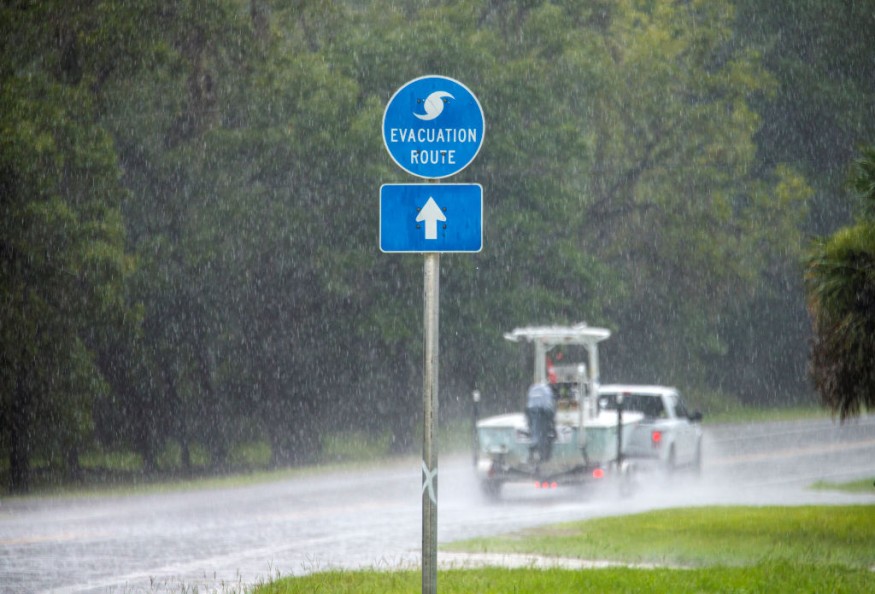
On Monday afternoon, the National Hurricane Center reported that Tropical Storm Fred made landfall near Cape San Blas in the Florida Panhandle.
According to the National Hurricane Center, Fred was about 15 miles south of Marianna at 8 p.m. ET, moving inland at ten mph. The storm's top sustained winds were around 50 miles per hour.
The National Hurricane Center said that Fred might bring storm surges, river flooding, and possibly tornadoes to the US coast, although the storm will weaken fast after impact.
PowerOutage.US forecasted that more than 36,000 consumers in northwestern Florida were without power by evening.
Other Active Storms
The National Hurricane Center is currently monitoring three Atlantic storms.
Tropical Storm Ida Grace is en route to Haiti, and Tropical Storm Henri sprang from the season's eighth depression on Monday. This is the fourth-earliest naming of an eighth storm in a season on record. Only 1936, 2005, and 2020 had dates that were earlier.
Henri was about 145 miles southeast of Bermuda on Monday evening, moving at five mph with maximum sustained winds of 40 mph.
Flooding Florida
The Florida Panhandle's coast is under a tropical storm warning for Fred, extending from the Okaloosa/Walton County line to the Steinhatchee River.
A previous warning for the area west of the county boundary has been removed. As a result, all classes and after-school activities were canceled in Bay County, Okaloosa County, Walton County, and Santa Rosa County schools. According to posts on each school district's website, classes are slated to resume on Tuesday.
According to the National Hurricane Center, the storm will produce isolated maximum rainfall of 12 inches over the Florida Big Bend and Panhandle through Tuesday. In addition, heavy rain is forecast in sections of southeast Alabama, Georgia, and the western Carolinas.
Storm Surges
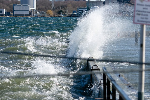
Storm surge is expected to be strongest between Indian Pass and the Steinhatchee River in Florida, with a 3 to 5-foot surge. From the Alabama-Florida border to Indian Pass, including Pensacola Bay, Choctawhatchee Bay, and Saint Andrew Bay, a storm surge of 1 to 3 feet is expected Monday.
Tornadoes are also a possibility as the storm approaches the coast. As a result, a tornado warning has been issued for Florida, Georgia, and Alabama.
"As Tropical Storm Fred approaches the Florida Panhandle shoreline, supercells moving inland in the northeastern and eastern sectors of the circulation may raise the hazard of a few tornadoes," the Storm Prediction Center stated.
Grace Pouring Over Haiti
Meanwhile, Tropical Depression Grace was pouring "torrential rains" over sections of Haiti and the Dominican Republic, according to the National Hurricane Center, potentially hampering Haiti's recovery operations following Saturday's devastating 7.2-magnitude earthquake.
On Sunday, Grace deteriorated to a tropical depression with maximum sustained winds of 35 mph, but it is projected to grow back to a storm by Tuesday.
The National Hurricane Center has issued a tropical storm warning for areas of Cuba's southern coast, including Santiago de Cuba and the Cayman Islands.
Storm Watch
A tropical storm warning has been issued for Haiti's entire coast, Jamaica, and parts of Cuba's southern coast.
The Dominican Republic is no longer under a hurricane watch.
According to the National Hurricane Center, Grace was about 60 miles southwest of Port-au-Prince, Haiti, 8 p.m. ET Monday.
Flooding rains are expected in Haiti and the Dominican Republic as a result of Hurricane Grace. On Monday and Tuesday, widespread rainfall of 5 to 10 inches is expected, with isolated amounts of up to 15 inches. This could result in flash flooding and mudslides.
According to the National Hurricane Center, grace might intensify to "near hurricane strength" after passing through Hispaniola. The National Hurricane Center announced that the storm is forecast to travel south of Cuba and toward the Yucatan Peninsula by the end of the week.
For more climate and weather updates, don't forget to follow Nature World News!
© 2026 NatureWorldNews.com All rights reserved. Do not reproduce without permission.


