AccuWeather meteorologists will be keeping an eye on portions of the Midwest for severe thunderstorms in the coming days, as the threat from Thursday will move farther south and east on Friday.

Multiple Thunderstorms Impacts Western Lowa
On Wednesday evening, multiple thunderstorms impacted western Iowa with intense winds. Sadly, a much larger region will be in danger into Thursday night, and wind may not be the only hazard. After a calm midday, Thursday evening will become stormy for the area as afternoon thunderstorms in Iowa, central Wisconsin and southern Minnesota and slice southeastward.
As the storms form initially, large hail will be the major threat. Also, isolated tornadoes are not out of the question. Later into the evening and overnight, two different rounds of thunderstorms may move across southern Wisconsin and northern Iowa. Milwaukee and Davenport, Iowa are just two places that are at risk of severe weather.
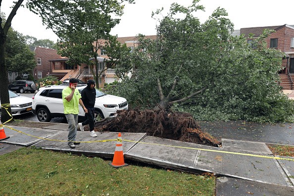
Once the storm clusters develop and become organized, the major hazard will move to the heavy rain and high winds, particularly for regions that are dealt over one thunderstorm. AccuWeather Meteorologist Rob Richards said: "The major risks will be flooding downpours and damaging wind gusts for this part of the country." Any heavy rain could bring about ponding on roadways.
Effects of Thunderstorms
Motorists along interstates 35, 39, 80 and 90 will need to reduce their speed and allow extra time to prevent hydroplaning. The storms will continue moving east late Thursday night, with Springfield, Illinois and Chicago; and South Bend, Indiana, at risk for very intense winds. The winds may be powerful enough to bring about power outages and even minor property damage.
Richards cautioned, "Some of the most powerful thunderstorms could produce wind gusts as high as an AccuWeather Local StormMaxTM of 90 mph." With the storms coming overnight in many places, residents will need to have the means to get alerted if a warning is issued for their location.
The storms are anticipated to weaken gradually as they keep moving farther eastward into Michigan and Ohio by Friday morning. However, the threat will not stop there.
Widespread Severe Weather
Richards stated that on Friday a cold front will march south and east, bringing about severe thunderstorms to form across the Ohio River Valley and into western Pennsylvania Indianapolis, Cleveland and Pittsburgh are a few areas that may have to cope with severe weather to end the week.
The storms will progress during the mid-afternoon hours and by evening it'll dive southward toward the Ohio River. Flooding, damaging winds, hail, and isolated tornadoes could take place as far south as northern Kentucky before the storms reduce later at night.
Isolated thunderstorms may affect some parts of the Northeast Saturday. While serious downpours and locally gusty winds are likely to occur, widespread severe weather is not anticipated.
Related Article : Full Spectrum of Extreme Weather Expected at North-Central U.S, Meteorologists Warn
For more news, updates about severe weather and similar topics don't forget to follow Nature World News!
© 2026 NatureWorldNews.com All rights reserved. Do not reproduce without permission.


