With barely a week into the 2021 hurricane season, US meteorologists have all their eyes turned to signs of growing tropical depression in the Gulf of Mexico.
Heavy rain and thunderstorm forecasts in the area are already raising some flags, while a slowly evolving atmospheric gyre is increasing the likelihood for more than one hurricane threat in the coming weeks. Other reports are also indicating that wind shear in the area is predicted to weaken by that time, and removes another mitigating factor against hurricanes in the area.
How does wind shear weaken tropical threats?
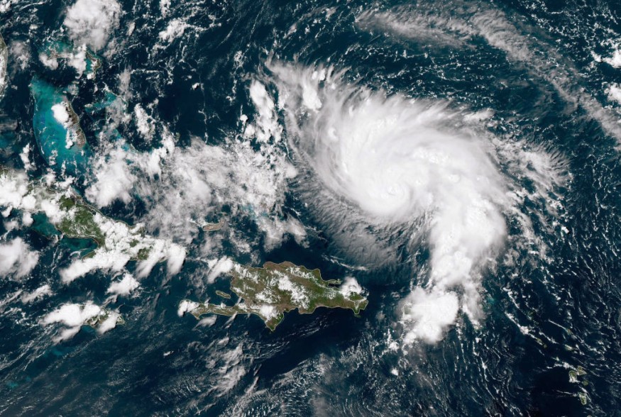
Wind shear is generally described as the change of direction in air currents and at increasing speeds over certain distances. They are divided between two types, horizontal and vertical (with the latter being a crucial obstacle against developing storms).
You could say that strong wind shear gets its name from the way it 'cuts' into a developing storm. It disrupts both the flow and temperature of the area and makes it harder for a cyclone to form.
But in the case of the Caribbean and the Gulf of Mexico, measurements are already indicating that the wind shear in the area has started to weaken. Meanwhile, warm waters from the summer season continue to set the stage for turbulent weather systems.
Atlantic hurricane season still dangerous enough this year
Even prior to the start of summer, the US has already experienced one close call when Hurricane Ana developed early and nearly grazed coastal cities back in late May. Ana was the first named storm to reach US waters and marked the first confirmation that this year will still experience above-average activity.
States that have had the highest risk of hurricanes are not taking any chances. Given the speed of ongoing vaccine rollouts, there is now more freedom of movement to prepare. Citizens are highly encouraged to make the most of their time stocking up on supplies and get ready for the increasingly high possibility of multiple storms across the next three months.
Tax holidays and other countermeasures are already in effect to prepare city populations for the season. Planners and local governments are once again reviewing drafts for dealing with floods and storm surges. Meanwhile, forecasters continue to monitor increasing thunderstorms and developing low pressure areas.
Freights and shipping organizations are also advised to adjust their schedules and inform their partnered logistics firms about making necessary changes in light of the increased activity. Manufacturers are encouraged to either have increased emergency supplies on-site or temporarily suspend operations at the first sign of a storm warning.
The succeeding years of above-average storm seasons have given a lot of steam for climate action advocacies. Warmer ocean temperatures only make it easier for hurricanes to form, and directly correlates with higher costs of disaster preparation. This is further worsened by increasing thunderstorms and arid climates that have made wildfires more likely in many parts of the US. In the coming years, it is very possible that the US could enter a vicious cycle of unmitigated emissions that will elevate hurricane season risks only higher.
© 2026 NatureWorldNews.com All rights reserved. Do not reproduce without permission.


