The U.S.' National Hurricane Center is currently stepping up the warnings it issues on storm surges by starting to publish maps this coming summer. These maps will show the areas where upcoming tropical storms will likely cause floods along the coasts of the Atlantic and the Gulf.
The color storm surge maps will serve a similar warning function that the traditional, older hurricane maps also provided. These were the maps that President Trump altered using a Sharpie last year to show (inaccurately) how Hurricane Dorian will possibly hit Alabama.
These new maps will feature red highlights on those coastal areas where flooding will possibly occur. They will also show the storm surge's expected height in several locations. The purpose of the maps is for warning the public regarding the potential danger usually overlooked by the people since they often focus on the hurricane's wind speeds and its likely paths.
The Miami-based Hurricane Specialist Unit is a branch of the National Hurricane Center. Its chief Michael Brennan said that it is easier and quicker to communicate the places where storm surges are expected to occur with the use of a graphic, such as a map.
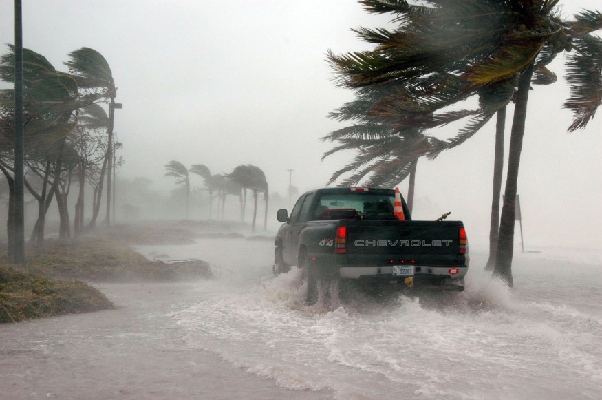
Storm surges from hurricanes are a severe threat to U.S. coastal communities. They cause dangerous flooding, and they reach inland, affecting sounds and bays. Superstorm Sandy was a weak hurricane before it made landfall last 2012. However, it caused a powerful storm surge that amounted to damages in billions of dollars on the coastlines of New Jersey and New York, which are densely populated.
In 2017, Hurricane Irma created a storm surge that caused massive flooding in the northeastern side of Florida, which caused four deaths. This is despite the storm making landfall in the state's southeastern side. The storm surge Irma created also caused damage to the U.S. Virgin Islands and Puerto Rico, even though these territories were not in Irma's path.
The center will release the maps about 48 hours before the time that hurricane surges and winds are forecast to hit the areas of the Atlantic Coast, Gulf Coast, the Virgin Islands, or Puerto Rico. These maps will utilize data collected by the hurricane center.
Natural Resources Defense Council senior policy analyst Anna Weber said that the maps and the information they provide are an excellent idea because graphics and maps are much more compelling compared to tables of numbers. Weber specializes in coastal resilience.
In 2017, the Weather Research & Forecasting Innovation Act was signed, which directed the NOAA, the body overseeing the National Hurricane Center, to make improvements in communicating and forecasting hurricane storm surges. However, Brennan said that the center on its own has already recognized the necessity for a better visual graphic of possible flooding from storm surges.
Currently, the center publishes various graphics depicting wind speeds of hurricanes as well as their arrival times and likely paths. Trump altered one of the maps last August to show Dorian moving squarely towards Florida. Trump bizarrely added a loop using black ink to erroneously show how Dorian could hit the southeastern part of Alabama.
In light of this, Weber said that she foresees how storm surge maps could be misinterpreted and used unintentionally to convey wrong information.
According to Brennan, the new maps will show additional information explaining when flooding will likely occur as well as expected storm surge heights.
© 2026 NatureWorldNews.com All rights reserved. Do not reproduce without permission.


