Temperatures are expected to drop in the central United States as a storm is expected to deliver rain and severe thunderstorms from Sunday into Monday. However, a winterlike storm from earlier in the month is not anticipated to repeat, according to reports.
The chilly air rushing in behind the storm will even cause some heavy snow to fall from the Northwest to the Colorado Rockies and northern Plains between a drastic temperature drop. The first target would be the Northwestern states with more rain and mountain snow.
According to AccuWeather Meteorologist Ryan Adamson, any snow will be primarily confined to the northern and central Rockies. He added it is unlike other storms that have already dropped vast amounts of snow in low elevations during fall.
Weather forecasts added the upcoming storm is expected by 10 to 20 degrees Fahrenheit from their peak from Saturday to a few days next week. Snowflakes may likewise mix with rain on several parts of northern Plains as the storm and cold air move eastward on Sunday.
It will likewise bring rain and thunderstorms to most midsection areas of the United States as the cold front will follow the storm. Several areas could also have one to two inches of rain, says AccuWeather meteorologist Tyler Roys.
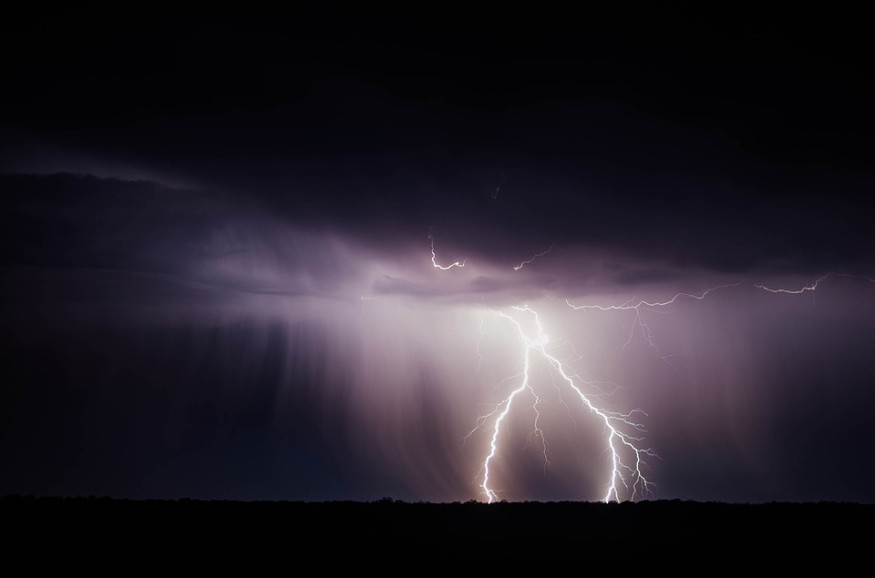
Heavy rain, strong winds, and an isolated will all be possible, according to Adamson. He added severe weather conditions are expected in some areas of central U.S. on Sunday evening. The weather forecast pointed out that the wind will be heading towards an "unseasonably warm" and humid air mass.
Central and eastern Oklahoma, southern Kansas to southwestern Missouri, northeastern Texas, and western Arkansas are the areas that are at risk for these locally severe thunderstorms.
Rain and thunderstorms are expected to head eastward on Monday. Heavy to locally severe thunderstorms are likewise forecasted to stretch from the Ohio Valley to the west-central Gulf Coast.
Adamson added that southern Texas, Mississippi, Tennessee, Louisiana, Kentucky, Illinois, and Minnesota might likewise experience heavy rain at the very least. Locals and tourists may also experience a combination of heavy rains and strong winds at the capital cities of Chicago, Houston, and Minneapolis. Highs will likewise drop to 10–20 degrees Fahrenheit as the storm passes by.
Temperatures will likewise drop across the northeastern United States and are forecasted to reach the lowest levels over the weekend. Clear skies, diminishing winds, and dry air.
Temperatures will likewise drop over the northeastern United States and are expected to reach the lowest levels so far during the morning hours this weekend. Temperatures may drop 10 degrees less than shortly after sunrise on Saturday, Oct. 19.
Diminishing winds and dry air, together with clear skies, will take the stage for a widespread frost and freeze on the northern parts of the country.
Some clouds, however, may prevent a quick temperature drop in mid-Atlantic and eastern Great Lakes region Sunday morning. New England, however, may experience a decrease in temperatures on Sunday morning.
Tropical Storm Nestor will likewise move close enough to the southern part of the mid-Atlantic region to bring rain and gusty winds Saturday night to Sunday morning.
© 2026 NatureWorldNews.com All rights reserved. Do not reproduce without permission.


