Meteorologists said that Norma, which is now a tropical storm, is seen to unleash heavy rains in Mexico.
They said that Norma is even expected to make two landfalls in the country.
Weather Track
The National Hurricane Center and Central Pacific Hurricane Center said that at 600 PM MDT (0000 UTC), the center of Tropical Storm Norma was located near latitude 23.3 North, longitude 109.8 West.
Norma is moving toward the north-northeast near 6 mph (9 km/h). This general motion should continue through tonight, and it will be followed by a turn toward the northeast and east-northeast on Sunday and Sunday night.
Meanwhile, based on the forecast track, the center of Norma is expected to continue moving across the southern portion of Baja California Sur tonight.
The weather system is also seen to move toward the west coast of mainland Mexico on Sunday and move inland within the tropical storm warning area on Sunday night or early Monday.
Weather experts said that Norma's maximum sustained winds have decreased to near 70 mph (110 km/h) with higher gusts.
On the other hand, continued weakening is expected during the next couple of days, and Norma is expected to approach the west coast of mainland Mexico as a tropical storm.
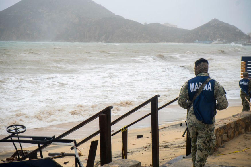
Tropical-storm-force winds extend outward up to 140 miles (220 km) while the estimated minimum central pressure is 986 mb (29.12 inches).
Meteorologists said that tropical storm conditions are occurring within the tropical storm warning areas in Baja California Sur.
Tropical storm conditions are also expected in the warning area along the west coast of Mexico by early Sunday.
When it comes to the amount of rainfall, Norma will produce rainfall totals of 6 to 12 inches with maxima of 18 inches across the southern portion of Baja California Sur through Sunday and across much of Sinaloa through Monday.
These amount of rainfall will produce flash and urban flooding, along with mudslides in areas of higher terrain.
On the other hand, a dangerous storm surge is likely to produce coastal floods in areas of onshore winds within the tropical storm warning area in Baja California Sur. Near the coast, the surge will be accompanied by large and destructive waves.
Due to this, coastal flooding is possible along the west coast of mainland Mexico within the tropical storm warning area.
Meanwhile, the surf swells generated by Norma will continue to affect the coast of southwestern and west-central Mexico and Baja California Sur for the next couple of days.
These swells are likely to cause life-threatening surf and rip current conditions.
Two Landfalls
Weather experts said that the storm could actually make two landfalls in Mexico.
The first one could fall on the southern tip of the Baja California Peninsula at the start of the weekend. Meanwhile, the second one could be on the western coast of the country's mainland.
Furthermore, the second landfall and corresponding second round of torrential rains with life-threatening conditions will likely unfold in the zone from Mazatlán to Culiacán on Sunday to Monday.
It is forecasted that tropical downpours are likely along Norma's path even as the storm's wind intensity steadily declines.
Related Article : Tropical Storm Norma Could Transform Into Hurricane; Might Make Landfall Over Mexico
Related Video:
© 2026 NatureWorldNews.com All rights reserved. Do not reproduce without permission.


