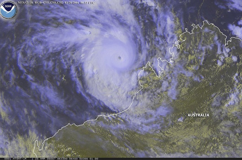
Severe Tropical Cyclone Charlotte is expected to weaken in the next 24 hours as it approaches Western Australia, according to Australia's weather forecast.
Meteorological authorities in the country said Charlotte could still bring gale-force winds and rain in the state over the weekend.
Charlotte has been forecasted to turn into a low-pressure system and may interact with another weather system.
The impact of the current weather disturbance is still present in the coming days, notably affecting areas along the coast of Western Australia.
Tropical Cyclone Weather Forecast

According to Australia's Bureau of Meteorology (BOM), Tropical Cyclone Charlotte was detected 690 kilometers west-northwest in the coastal town of Exmouth, Western Australia, at 2:00 a.m. AWST (local time) on Thursday, March 24.
Charlotte is moving southwest at a speed of 11 kilometers per hour.
In addition, the BOM issued a tropical cyclone bulletin or weather forecast for the storm, indicating that the storm is likely to weaken below a tropical cyclone intensity later on Thursday.
However, Charlotte is still forecasted to produce gale-force winds on both its eastern and western sides until Friday, March 25.
Its impact in coastal areas in Western Australia can cause damaging weekends over the upcoming weekend between Saturday, March 26, and Sunday, March 27.
Heavy rain is possible in Shark Bay with the occurrence of high tide.
Furthermore, a storm surge or strong ocean waves are possible due to the gale-force winds from Tropical Cyclone Charlotte.
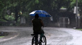
Based on the weather forecast, a downpour of torrential rain will cover the western half of Australia over the weekend.
By this time, the cyclone has already turned into a low-pressure system.
Also Read: Australia Prompts Immediate Evacuation of 200,000 Due to Flash Floods Warning
The Aftermath of Eastern Australia Flooding
The storm in Western Australia comes during the aftermath of the extreme flooding in Eastern Australia between February and March, affecting the states of New South Wales (NSW) and Queensland (QLD).
The flooding resulted in widespread travel disruption and business disruption in the states.
The flooding in NSW and QLD started in late February and lasted until early March.
The extreme yet unusual weather at that time was also accompanied by several days of torrential rain, including the occurrence of "rain bombs" and tornado-strength winds, according to the Center for Disaster Philanthropy (CDP).
On Feb. 24, a rain bomb struck Brisbane, QLD, knocking out powerlines and causing large-scale damage in Australia's third most populous city for several days, says CDP.
Moreover, the amount of rain that the city received is significantly greater than has been seen in decades.
In NSW, heavy downpours and flash floods have resulted in several casualties and thousands of evacuations.
The extreme weather event affected multiple parts of Sydney, including the Sydney metropolitan region, Illawarra, Hunter, and some parts of the south coast districts, as per The Guardian.
Overall the two Australian states received more than a year's worth of rainfall in a week.
The western half of Australia, which includes the state of Western Australia, is prone to cyclones coming from the Indian Ocean.
According to the BOM's cyclone climatology page, the tropical cyclone season in Australia occurs from November to April.
The BOM added that the highest risk for the formation of category 4 or 5 cyclones is in the months of March and April.
Related Article: Despite a Break From Torrential Rain, Australia Still Braces For Flash Floods
© 2024 NatureWorldNews.com All rights reserved. Do not reproduce without permission.


![Roundworms with Short Memories 'Stop Forgetting' When Frozen or Given Lithium [Study]](https://1471793142.rsc.cdn77.org/data/thumbs/full/70295/280/157/50/40/roundworms-with-short-memories-stop-forgetting-when-frozen-or-given-lithium-study.jpg)

