The latest weather report shows that potentially severe storms can bring damaging hail conditions this week, causing hazardous road commutes from the Central Plains to the Lower Missouri Valley. Motorists traveling this week should keep updated with the latest forecasts before traveling in the affected areas with severe weather threats.
In a National Weather Service (NWS) report, a severe weather outlook is likely in the Great Lakes and Ohio Valley, spreading over parts of the middle Mississippi Valleys and Southern Plains on Thursday.
The forecast warns of showers and thunderstorms in parts of the Lower Michigan and Ohio Valley. For homeowners, they should watch out for potentially damaging winds, large hail, and tornadoes. Isolated flash flooding and locally heavy rainfall are also likely.
Additionally, isolated tornadoes are dangerous, particularly at night. Homeowners are advised to check for a tornado watch and a tornado warning in their areas, including turning on mobile advisories.
Weather in the Central Plains and Lower Missouri Valley
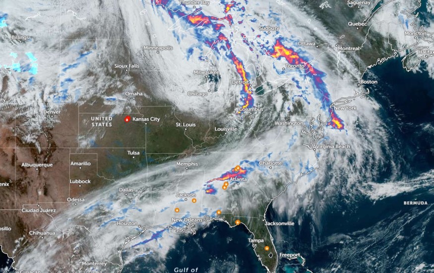
The NWS forecast warns of stormy conditions from the central Plains into the lower Missouri Valley, causing possible damaging hail. The main threat is expected in the Mid-Mississippi Valley, bringing strong to severe thunderstorms.
In eastern Missouri and southern Illinois, the NWS Storm Prediction Center shows that an enhanced risk can unload in the region, including in northwestern Tennessee, extreme southwest Indiana, and southwestern Kentucky.
In addition, Southern Plains residents should stay alert for widespread heavy rains, damaging winds, and isolated flash flooding this week. The rainy conditions can likely trigger potential landslides and flooding concerns in the region.
Recently, the forecast monitored the development of scattered severe thunderstorms, with a slight risk level 2, in Lower Michigan and the Midwest. In the affected areas, limiting outdoor travel is advisable due to potentially severe weather threats. Outdoor activities can encounter travel disruptions due to slower commutes from rounds of rain.
From Kansas to Missouri, residents should watch out for tornado risks.
Nighttime Severe Risk in Parts of the U.S.
On the other hand, the latest NWS reports reveal that damaging and dangerous thunderstorms can impact portions of the Great Lakes and Central Appalachians. The main concern is severe storms at night, which can bring the same weather risks to the Central Plains and Missouri.
On Wednesday evening, the risk of severe weather can occur in the following areas:
- Flint
- Detroit
- Cincinnati
- Cleveland
- Columbus
- Pittsburgh
- Lexington
- Charleston
- Charlottesville
- Kansas City
For homeowners, having emergency kits is essential during challenging weather conditions, including severe weather threats. When tornadoes touch down, it is best to evacuate into secure areas inside homes, avoiding doors, windows, fragile materials, and cabinets.
For more similar stories, don't forget to follow Nature World News.
© 2026 NatureWorldNews.com All rights reserved. Do not reproduce without permission.


