A recent study stated that the San Andreas Fault would likely shake 65% less than what has current hazard models say.
Experts recently disclosed that the Mojave section of this fault is expected to unleash a massive earthquake to rival any other shakes in Los Angeles' previous years or those dubbed as the "Big One."
San Andreas Fault Not as Destructive as Previously Thought
They said that up to at least a 7.8 magnitude, this earthquake could wreak havoc on much of the areas situated in Southern California. This could later topple buildings or trigger widespread evacuations.
However, they said that this event may not be as destructive as previously thought, particularly the area near Los Angeles.
They explained that precariously balanced rocks (PBRs) at Lovejoy Buttes have survived the ground motions of the past tens of thousands of years of earthquakes on the Mojave section of the San Andreas Fault.
Therefore, PBRs provide crucial ground-motion constraints over the timescales of rare, large San Andreas Fault earthquakes.
Researchers calculated the vector fragility (PGA and PGV/PGA) of each studied PBR, and model the age of each rock using cosmogenic 10Be exposure dating. They used this independent observational data of PBR survival at Lovejoy Buttes to rigorously validate and update an earthquake hazard model (UCERF3 and SWUS) for the Mojave section of the San Andreas Fault.
They noted that importantly, this site-specific validation considers the joint probability of survival of a population of five PBRs and the uncertainty in the fragility and fragility age characterization of each rock.
The validation had tested the entire distribution of hazard estimates to update the logic tree end-branch weights using Bayesian updating to deliver an improved, PBR-informed earthquake hazard estimate.
They said that at an annual frequency of exceedance of 1x10⁻⁴ yr-1, equivalent to an earthquake mean return period of 10,000 years, the PBR survival data significantly reduces the mean hazard ground-motion estimate by 65% and the 5th-95th fractile uncertainty range by 72%.
''The magnitude of inconsistency between the ground-motion estimates and the PBR data is clear evidence for the need to reevaluate our earthquake hazard model for the southern San Andreas fault,'' the experts said.
At present, earthquake risk models are mainly based on extrapolations from limited historical timescale and ground motion recordings from past quakes.
But fortunately, a different group of sentinels have witnessed and captured data from these temblors for much longer than humans, which are the rocks.
Read Also : What Will Happen If San Andreas Fault Ruptures?
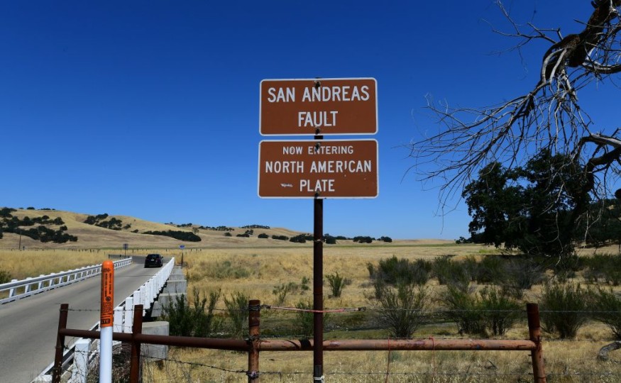
San Andreas Fault
Authorities said that the 1,200-kilometer-long San Andreas Fault zone is part of the boundary between the Pacific and North American plates, and thus is known as a transform fault.
It usually connects the East Pacific Rise in the Gulf of California with the junction of the Mendocino fracture zone and the Cascade subduction zone to the north.
The Pacific plate has moved about 300 kilometers northward relative to the North American plate since the fault began, some 30 million years ago.
Moving at 5 to 7 centimeters a year, the San Andreas is one of the most active fault zones in the world.
© 2026 NatureWorldNews.com All rights reserved. Do not reproduce without permission.


