The latest weather report warned of heavy snow in the High Plains and Rockies this week. Residents should also anticipate the colder conditions and travel concerns.
The National Weather Service (NWS) monitors the cold front in the Upper Great Lakes in the midweek, producing potential light to moderate lake-effect snow.
The December beginning brought heavy snow and colder temperatures to the US, especially in the Northeast and Pacific Northwest. As Christmas becomes closer, homeowners should prepare for the winter with extreme cold.
In this week's weather, the main dangers are slippery outlook and cold-related illnesses such as hypothermia and frostbite. Homeowners should repair and check their heating and plumbing systems due to freezing to extreme cold.
NWS Weather Forecast: Extreme Cold and Heavy Snow
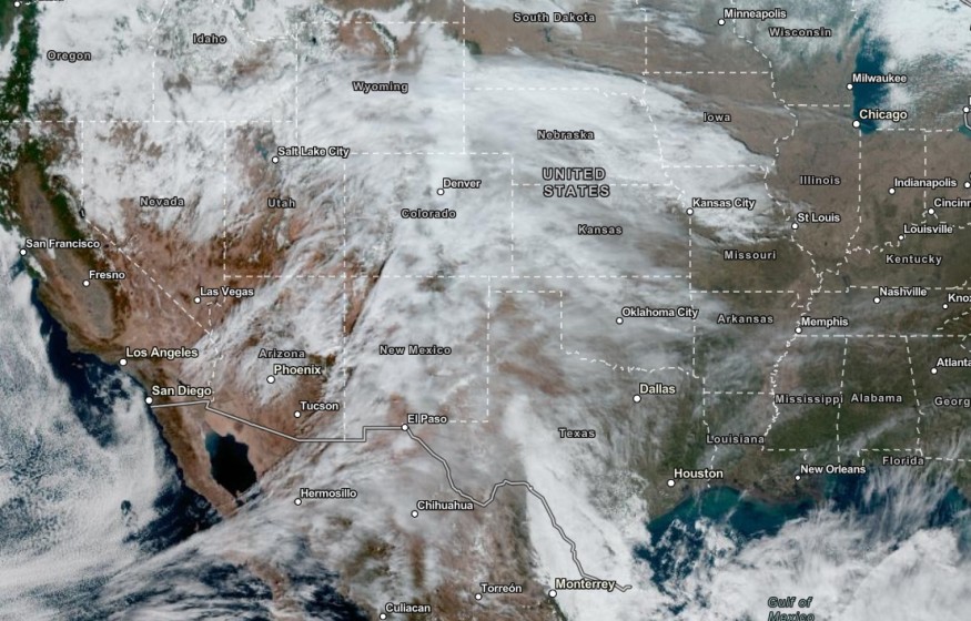
According to the NWS Weather Discussion, above-average temperatures are likely on the East Coast, Great Lakes and Midwest. Temperatures will be chilly with a heavy snow outlook in the Central and Southern Rockies.
In the advisory, a cold front over the Great Lakes will help with the lake-effect snow in the region on Wednesday. In the Pacific Northwest, a moist condition will continue, bringing excessive rainfall risk and flash flood threats.
In addition, light to moderate snow is likely in the mountainous areas. Freezing rain or a mix of snow can occur. Homeowners should avoid prolonged exposure to chilly weather due to possible hypothermia and frostbite.
If they go outside, it is best to wear winter clothes or protection. Homeowners should also protect their plants, pets and crops from freezing outlook.
Weather in the Southern US
Meanwhile, the weather in the Southern US will bring a blast of snow and rain in the late week. People with planned travel should consider the weather due to road hazards or disruption.
The stormy outlook will be helpful with drought-affected areas in the South, especially in the following areas:
- Oklahoma City
- Lubbock
- Odessa
- Laredo
- Dallas
- Amarillo
Snow outlook will likely unload in Amarillo, Albuquerque, Pueblo and Durango. The snow can spread over South-Celtra Colorado and New Mexico.
In the Gulf of Mexico, residents can expect a rainy outlook to break the early dry spell in the region. The rain can return to parts of Houston, Dallas and New Orleans.
On the weekend, the threat of storm will unload in Virginia Beach, Raleigh, Charlotte, Columbia, Atlanta and Nashville. Over the East Coast, the forecast shows that a cooler outlook can likely start Wednesday.
Related Article : Tornado Cleanup in Tennessee: Colder Temperatures to Unfold This Week
For more similar stories, don't forget to follow Nature World News
© 2026 NatureWorldNews.com All rights reserved. Do not reproduce without permission.


