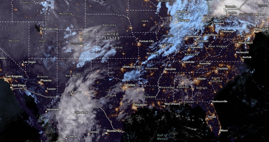
Colorado and Utah can expect a quick-moving storm and a cold front that could bring cooler conditions to the region this week, causing extremely dangerous travel.
The weather in Colorado and Utah has experienced colder conditions and snow. Colorado is no stranger to chilly outlook and high-elevation snow in early October.
Look we are not here to rain on anyone's parade (mostly because there isn't much of a chance for rain in the forecast) but, it you've liked this return to near normal November temperatures, that's going to be short-lived.#KCAboveTheNorm pic.twitter.com/e2p97tjsVJ
— NWS Kansas City (@NWSKansasCity) November 9, 2023
In this week's weather, the main concerns are cold-related health risks and dangerous travel conditions. The freezing outlook can likely damage power lines, crops and plant.
Quick-moving storm, Cold Front to Bring Cooler Conditions

Colorado and Wyoming also experienced fire risks due to low relative humidity and strong winds. Although the colder weather is in the air, residents should stay alert for fire concerns.
In portions of Colorado, snow accumulations can bring one to two inches of snow in parts of San Juan, Wet Mountains and Southern Sangres. The forecast warned of travel impacts this week, especially in the La Veta Pass.
On the Interstate 25 corridor, a mix of rain and snow can unload in the late week. The forecast added that Raton Mesa can anticipate slick conditions.
Over the Central and Southern Divide, the temperatures can be 5 to 10 degrees below normal. On Friday, Colorado and Utah can anticipate a dry weather outlook. From the weekend to early next week, above-normal temperatures can likely unload next week.
In the midweek next week, an unsettled weather pattern is also possible. Over Western and Central Wyoming, residents should watch out for elevated fire weather that could unfold in the late week, especially in the Sweetwater Country and Natrona County.
In addition, the National Weather Service (NWS) warned of dense fog and road hazards. The forecast warned that vehicles should slow down while driving, and stay alert for weather dangers.
Over the West Coast, heavy precipitation can start in the late week, including in parts of the Central and Western Gulf Coast. Homeowners should check for flooded roads and potential flash flood risks.
In Kansas City, residents can anticipate normal temperatures this November. However, the report warned that it could be short-lived.
Weather in Colorado and Utah: How Can Homeowners Prepare?
The weather in Colorado and Utah can be colder, with a chance of snow in low and high-elevation areas. Here are essential weather reminders for this coming colder weather in the region.
Homeowners should limit any outdoor activities as possible this week due to challenging road conditions. It is advisable to stay at home as possible due to the slick road.
Did you know? According to the NWS Climate Prediction Center, El Nino is forecast to pursue in the Northern Hemisphere, from April to June 2024. The El Nino advisory is still in effect, which can affect the weather pattern.
Related Article : US Weather Forecast: Localized Flooding, Heavy Rains to Hit Texas, Louisiana This Week
For more similar stories, don't forget to follow Nature World News.
© 2026 NatureWorldNews.com All rights reserved. Do not reproduce without permission.


