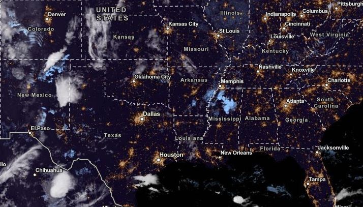
Severe storms will likely unload in New Mexico and West Texas, with possible thunderstorms and rainy conditions.
Americans with scheduled outdoor activities should consider checking the latest weather forecasts due to potential flash flood risks and rounds of heavy rain.
In addition, the rain can also help ease the warmer and hotter conditions in the region, especially for drought and dry areas.
Severe Storms To Hit New Mexico, West Texas
In the latest weather advisory, the National Weather Service (NWS) reported that severe storm conditions are expected in the following areas:
- High Plains
- Eastern New Mexico
- West Texas
In the Southern Plains, the southerly winds can help unleash the region's possible thunderstorms and rain showers in midweek. There is a possibility of hail conditions and damaging winds.
Homeowners should monitor the weather due to the impacts on homes of strong wind conditions. It is best to secure outdoor equipment and stuff to avoid being blown away by the damaging winds.
The stormy outlook is forecast on Monday in eastern New Mexico and West Texas. Residents can anticipate the stormy outlook early this week. The main concern is the flooding rainfall, affecting the low-lying areas in the Southeast and Texas.
Weather in the Eastern US
The Eastern US and Central US weather is expected to experience unusually warm conditions and above-normal temperatures due to the high pressure developing in the region.
Starting Tuesday to Wednesday, the warm conditions are forecast in the following areas:
- Portland
- Boston
- New York
- Washington
- Virginia Beach
- Pittsburgh
- Charleston
- Ottawa
- Detroit
On Tuesday, the warm air can likely move in Green Bay, Chicago, Detroit and Indianapolis. The forecast noted that affected areas can reach from 10 to 15 degrees above historical average.
The sudden shift to warm temperatures is favorable for people who want to enjoy the summer at the last minute, especially since the East Coast suffered from recent relentless rounds of heavy rain and flooding concerns.
In the Central US, the heat will likely stay this midweek.
Weather in the Midwest: Unusual warm in October
The National Weather Service (NWS) noted the warm and record-breaking temperatures in the Midwest this October.
According to reports, the temperatures can reach in 80s to 90s.
On Tuesday, the challenging heat can unfold in Kansas City, Fargo, Sioux Falls, Duluth and Omaha. Older adults, children and people with medical conditions should limit exposure to the heat this week due to heat-related health risks.
The heat can also reach Wichita, North Dakota, Wisconsin, Minnesota and Nebraska this week.
Keeping safe from the heat and severe storms this week
The challenging weather conditions can bring significant risks to Americans, especially for people in flood-prone and low-lying areas in Texas and Southeast.
Staying updated with the latest weather reports is recommended. Power outages are possible, and it is best to keep battery-powered radios and emergency kits at home.
Related Article : US Weather Forecast: Unusual Warmer Outlook To Hit East Coast, Central US After Experiencing Relentless Rain
For more similar stories, don't forget to follow Nature World News.
© 2026 NatureWorldNews.com All rights reserved. Do not reproduce without permission.


