At Category 2, Hurricane Lee moves north to the East Coast US as it grows in size.
Despite being reduced to Category 2, Hurricane Lee has expanded into a huge storm, with hurricane-force winds extending more than 100 miles in every direction from the storm's eye as it moves far off the US East Coast in a northerly path.
Downgraded But Still a Threat
Although Lee reached a Category 5 storm early on, when it was still approximately 300 miles east of the Caribbean, it has since lost strength and as of Wednesday afternoon, is just a Category 2 hurricane. However, according to Kristen Corbosiero, an atmospheric scientist at the University at Albany, the decrease in wind speed is not a cause for complacency.
Additionally, according to Corbosiero, it doesn't imply that the storm is any less hazardous. Strong winds are present over a significantly wider area, even though their severity has decreased. She claims that if it makes landfall, more people could be affected.
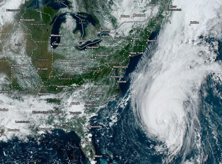
Due North to East Coast US
Currently hundreds of miles off the Florida coast, Hurricane Lee is anticipated to move north until Friday. At the end of the week, it is expected to reach landfall, maybe in New England but more likely in Atlantic Canada. However, because of the storm's size, its effects could be felt along a considerable portion of the coast. It is more than just a location on a map, according to Corbosiero. People should unquestionably be keeping an eye on the forecast along the East Coast, spanning from New Jersey upwards and into coastal Canada. She adds that residents of these places should, at the very least, prepare for powerful rip currents.
Growth of Hurricane Lee into a Sprawling Storm
According to Corbosiero, several factors contributed to the growth of Hurricane Lee.
For one thing, hurricanes frequently grow in size as they go north. The Coriolis force, a phenomenon produced by the interaction between the rotation of the Earth and the atmosphere, is what causes this growth to happen naturally even if it can be caused by interactions with other systems. According to Corbosiero, this force is stronger as it reaches higher latitudes. So, as a hurricane moves toward the north, it draws in air that has a stronger Coriolis force, which intensifies the storm.
An eyewall replacement cycle, as described by scientists, was also another phase that Hurricane Lee went through. The "eye of the storm," a calm area within a tropical cyclone, is encircled by an interior eyewall, a ring of powerful thunderstorms.
The fastest winds plus the heaviest rain are located in the eyewall, as Corbosiero says.
A second storm ring may develop around the eyewall in the case of a strong hurricane, however, scientists are unsure of why. According to Corbosiero, the newly formed ring of thunderstorms and strong winds absorbs all the energy and steals it from the inner, original eyewall. The storm grows larger since the new eyewall continues to be outside of the previous one. When hurricanes eventually make landfall, they have a very broad wind field, which is fairly common and can be hazardous.
Rapid Intensification, Rapid Weakening
One of the features Hurricane Lee has shown off throughout its week-long journey over the Atlantic is the replacement of the eyewall. Hurricane Lee also had rapid intensification, which happens when a storm's winds grow by at least 35 miles per hour in less than 24 hours; at the end of last week, Lee's strongest gusts had increased to about 80 mph. But soon after, the storm underwent the opposite, less well-understood phenomena of rapid weakening, which baffles meteorologists.
© 2026 NatureWorldNews.com All rights reserved. Do not reproduce without permission.


