A developing tropical wave in the Bahamas can bring rainy conditions and thunderstorms in Florida and Southeast this week, according to the latest weather forecasts.
The early beginning of July recorded severe weather threats and brutal heat in the United States.
Hotter conditions were recorded in the Southwestern US and Florida.
In Florida, Nature World News (NWN) and The Guardian reported that ocean temperatures reached an unusual 101.19, causing concerns about the impact on coral reefs.
CNN recently reported that rising temperatures in Florida's Key coast could result in coral deaths. Experts have been monitoring the temperatures in Florida waters.
Hotter temperatures can cause coral bleaching that affects their overall health.
Meanwhile, Florida can expect stormy weather conditions that could bring rain and gusty thunderstorms.
Tropical waves and gusty thunderstorms in Florida
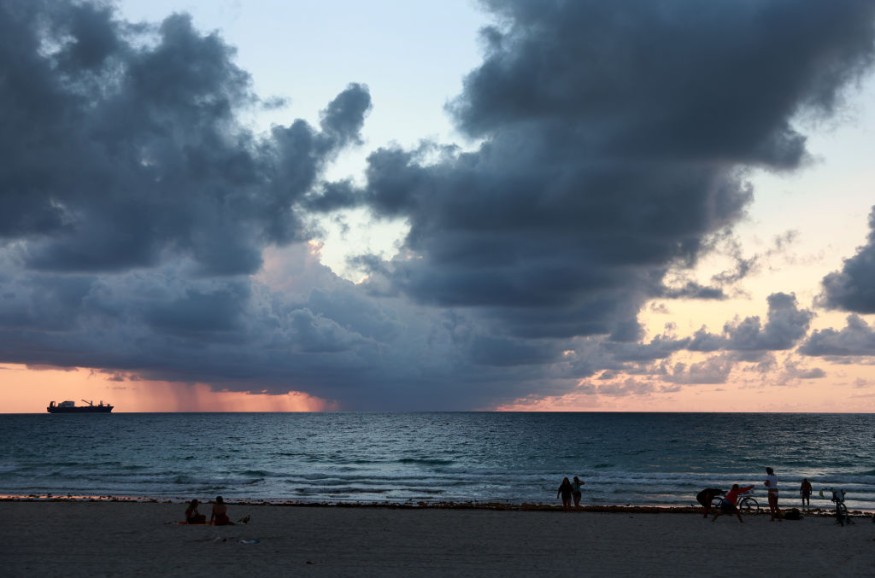
According to The Weather Channel's forecast, Florida could likely experience wet weather this week due to a developing tropical disturbance.
Meanwhile, AccuWeather's report showed that a developing tropical wave near the Northern Bahamas could bring thunderstorms by the end of the week.
The report added that the agency has been monitoring three tropical waves in the Atlantic basin.
There is a possibility that the disturbance could result in waterspouts and rip current conditions.
Furthermore, the forecast said the local thunderstorms could also impact parts of Georgia, Miami, West Palm Beach and Fort Lauderdale.
While the weather could offer relief in Florida, residents should monitor the weather conditions for possible thunderstorms and slower commutes.
The forecast noted that more tropical waves could likely develop in August.
Staying safe from the stormy weather
As hurricane season begins, tropical disturbance development could emerge, causing strong winds and flooding downpours.
It is best that homeowners near flood-prone areas should keep updated with the weather conditions.
Last year, Hurricane Ian left devastating damage in Southwest Florida. It resulted in heavy flooding that destroyed many homes.
According to Fox Weather News, Lee County in Florida recorded the most fatalities from Hurricane Ian.
As a result, disaster preparedness is vital to prevent potential damages, injuries and deaths. Here are essential reminders to stay safe from powerful storms.
Stay alert and updated with weather news
The American Red Cross reported the importance of staying connected. Homeowners should keep updated with emergency alerts and news.
Keeping a battery-powered radio would be handy and helpful in power outages.
In addition, it is best to immediate evacuate if there are announcements. People should also monitor the rapid rising of floodwaters.
Meanwhile, homeowners should stay at home when the weather becomes severe.
Keeping emergency supplies
While no one expects severe weather or hurricane, homeowners should consider keeping emergency kits at home, with medicines, non-perishable goods and battery-powered radios.
Did you know?
According to CBS News, Hurricane Camille was one of the strongest hurricanes in the US. The report said the hurricane developed over the Caribbean.
The hurricane hit parts of the Gulf of Mexico, Mississippi, Kentucky, Virginia, and Tennessee, leaving 256 deaths and $1.4 billion in damages.
Related Article : Florida Ocean Temperature Reaches Over 100 Degrees; Temp Likely to Become World Record
For more similar stories, don't forget to follow Nature World News.
© 2026 NatureWorldNews.com All rights reserved. Do not reproduce without permission.


