According to weather predictions made by the Philippine Atmospheric Geophysical and Astronomical Services Administration (PAGASA), tropical depression Gardo and super typhoon Hinnamnor, both of which are currently outside the Philippine Area of Responsibility (PAR), may merge within the next few days, bringing with them strong winds brought on by habagat.

Henry (Hinnamnor) Merges with Gardo
The domestic name "Henry" will be given to Hinnamnor when it enters PAR on Wednesday night (Aug 31). It is now traveling southwest at a speed of 30 kph, according to PAGASA.
PAGASA put the super typhoon 980 kilometers northeast of northern Luzon in its tropical cyclone bulletin at 11 a.m. on Wednesday. It had maximum sustained winds of 195 kph and gusts as high as 240 kph.
While everything was going on, tropical depression Gardo was estimated to be 1,140 kilometers east of northern Luzon, with maximum sustained winds of 55 kph and gusts as high as 70 kph near the center. According to PAGASA, Gardo is traveling northeast at 10 kph.
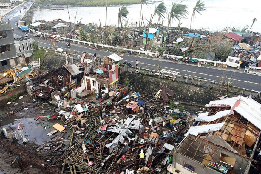
Extreme Weather Intensifies
The Super Typhoon Hinnamnor, known as Henry domestically, may grow in radius or diameter due to their collision. So, according to PAGASA weather expert Ana Clauren, it will strengthen and strengthen the southwest monsoon.
Although PAGASA does not anticipate weather disturbance to make landfall, meteorological developments may cause a tropical cyclone wind signal to develop over extreme Northern Luzon in the following days.
In less than 24 hours, Hinnamnor might attain a peak intensity of 205 km/h before waning gradually as it transitions into its quasi-stationary phase. By Friday afternoon or evening, this tropical storm might be reduced to a typhoon, according to the state weather bureau.
Additionally, Extreme Northern Luzon may get mild to moderately heavy rainfall linked with the super typhoon's outer rainbands starting on Thursday (Sept 1) or Friday (Sept 2).
Additionally, PAGASA warned that this tropical cyclone "may strengthen the southwest Monsoon and deliver monsoon rains across the western half of Luzon commencing on Friday."
The weather bureau advised the public to continue monitoring for updates on the tropical cyclone.
Typhoon vs Super Typhoons
People wonder what the distinction is between a typhoon and a super typhoon as the situation worsens.
Typhoons and hurricanes are regional names for tropical cyclones, the same meteorological phenomena. Tropical cyclones are powerful circular storms with low air pressure, strong winds, and heavy rain that form over warm tropical waters.
As long as they are above warm water, they can maintain their vigor since they get their energy from the sea surface. Tropical cyclones produce winds that are faster than 119 km/h (74 mph). The strongest ones generate sustained winds of 240 km/h (150 mph) and gusts above 320 km/h (200 mph).
When a typhoon's sustained surface wind speed reaches 240 km/h (150 mph), the equivalent of a powerful category 4 or category 5 hurricane, the term "super typhoon" is used.
Some weather agencies have lower thresholds than others, including the Hong Kong Observatory, which classifies super typhoons as storms with sustained wind speeds of 185 km (roughly 115 miles per hour), and the Japanese Meteorological Agency, which classifies violent typhoons as storms with sustained wind speeds of 194 km (roughly 120 miles per hour).
Related Article : Exposure to Major Disasters Can Cause Long-Term Mental Health Problems
For more climate and weather updates, don't forget to follow Nature World News!
© 2026 NatureWorldNews.com All rights reserved. Do not reproduce without permission.


