The tropical disturbance could potentially be the next named storm in the Atlantic basin, according to AccuWeather meteorologists.
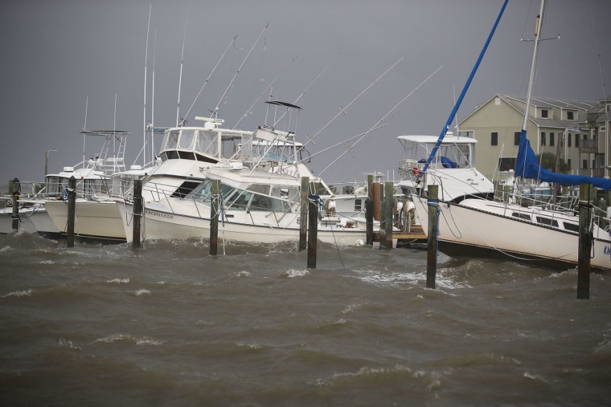
The national weather news channel forecasts that the 'homegrown' tropical depression could emerge in the northern Gulf of Mexico in the coming days, anywhere along the coast from Louisiana to northwestern Florida. Meteorologists warn that it could worsen the ongoing concerns in the Southeast for floods.
As per AccuWeather Meteorologist Brandon Buckingham, the formation of the tropical system from the northern Gulf of Mexico to waters along the southern Atlantic coast has been a concern over the past few weeks as fronts have stalled nearby, while Southeast deals with ongoing flood surge.
The threat has "risen as a result of a constant barrage of storms that have marched through the Plains and Ohio Valley," he explains, thus "allowing cold fronts to drift unusually far south for this time of year and stall in the Southeast states."
What is a Homegrown Tropical System?
A homegrown tropical system develops near the coast of the United States and usually a product of a low-pressure area that was previously over land. While this kind of disturbance does not happen every year, it could potentially start tropical systems during the early part of the hurricane season.
For example, Tropical Storm Colin along the South Carolina coast was a product of this pattern and can potentially spin up the next tropical depression or storm of the year in the Atlantic, which will be named Danielle.
Before any official designation from the National Hurricane Center could be given, AccuWeather is designating the system as a tropical rainstorm due to the potential life-threatening and damaging flood that could evolve this week. Its proximity to land may prevent development or rapid intensification should the depression or storm take shape along the upper Gulf Coast.
Nonetheless, meteorologists forecast above average water temperatures for this point in the season and are generally near 90 degrees Fahrenheit, well above the minimum threshold of 78 for tropical development.
Low Wind Shear
As for the variation in wind velocity over the northern Gulf of Mexico as opposed to the waters along the southern Atlantic coast, the weather experts say it would be rather low, but will remain high over much of the rest of the Atlantic basin for the remainder of the week.
This means the tropical depression would not be able to churn seas to the point of being a major threat to petroleum operations in the Gulf, but can most likely generate a dangerous rough surf, beach erosion and gusty winds for coastal interests, as per AccuWeather. The channel also warns downpours and potential threat of lightning strikes.
"The heaviest of these downpours will begin to hone in on a more confined portion of the Gulf Coast as the potential tropical concern arises," says AccuWeather Meteorologist Mary Gilbert.
Elsewhere across the Atlantic basin, tropical concerns in the short term are being monitored, particularly the conditions over a portion of the open Atlantic Ocean, east of the U.S. and north of Bermuda, which could become conducive enough to support brief tropical development.
Related article : Temperatures In the Deep North Atlantic Ocean were Once as Warm as the Mediterranean
© 2026 NatureWorldNews.com All rights reserved. Do not reproduce without permission.


