Flooding due to the heavy rain in Australia's east coast has submerged multiple areas across Sydney, New South Wales, as of Tuesday, July 5.
Local officials ordered approximately 50,000 residents in the city and its surrounding areas to evacuate and leave their homes.
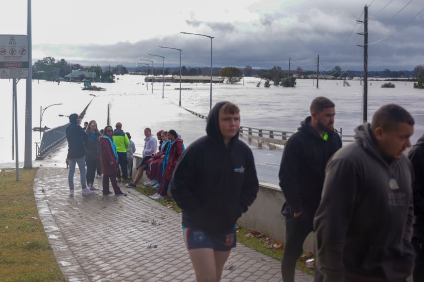
This comes as river levels started to swell up beyond its designated danger levels, threatening Sydney and its suburbs, especially in the western portions.
The order also included warning to Australians who could also receive evacuation orders soon.
Flash flooding in New South Wales on Monday, July 4, has led to the initial evacuation of 30,000 people in the Australian region, making the latest round of evacuees to increase by 20,000 based on reports on Tuesday.
Floodwaters also threaten road travel and commercial establishments across the state.
Substantial risks of flooding are high for low-lying areas, as well as communities near the east coast and inland rivers. Such dangers have prompted Australian weather authorities to issue multiple major flood warnings since the weekend.
The major flooding in New South Wales comes several months after torrential rain, driven by the La Niña weather phenomenon, soaked the state, Queensland, and adjacent areas.
The first quarter of 2022 saw a large-scale evacuation in Eastern Australia, becoming one of the worst natural disasters in the country's history.
NSW Flooding Forecast
The Bureau of Meteorology (BoM) of Australia issued multiple flood warnings for New South Wales over recent days, starting from Friday, July 1.
The initial forecast suggested that increased showers and a "Severe Weather Warning" for heavy rainfall is imminent for the following areas that time:
- Sydney metropolitan
- Illawarra
- Central Tablelands districts
The weekend BoM weather advisory saw the continuance of excessive rainfall across the region.
This paved the way to the first prediction of a potential major flooding forecast for different parts of New South Wales.
The weekend flood warnings were issued for Hawkesbury, Nepean and Colo rivers.
Also Read: Australia: Bureau of Meteorology Issues Storm Warnings and Flood Warnings for Lismore This Week
East Coast Low
The latest BoM forecast suggested that flooding risk still remains for some parts of New South Wales even if rainfall eased on Monday.
The following areas are still experiencing major flooding at the time of reporting:
- Hawkesbury and Nepean rivers in Menangle
- Wallacia
- North Richmond
Moreover, major flooding is also expected in Windsor, Lower Portland, and Wiseman Ferry.
The issuance of further severe weather warnings is possible, due to the risk of damaging winds and hazardous surf for New South Wales.
Aside from flash floods, the BoM said landslips could also possibly occur, which is likely in mountainous areas.
The Australian weather agency calls the inclement weather in general as a "East Coast Low," due to weather system located in the country's eastern portion.
As of Tuesday, officials said that emergency crews are still continuing their rescue operation, including on a bulk carrier ship which lost power off the Sydney coast due to severe weather in the rough seas, as cited by Reuters.
While floodwaters submerged bridges, roads, and vehicles, there were no immediate reports of deaths.
© 2026 NatureWorldNews.com All rights reserved. Do not reproduce without permission.


