Florida received a substantial amount of rainfall from an unnamed storm system over the past several days, causing widespread flash floods and urban flooding.
In particular, the system placed South Florida and the Florida Keys into a standstill as disruption to both residential and commercial establishments have been reported, as well affecting local travel.
As part of recurring US weather updates this week, the weather disturbance is the same tropical storm system that has been lurking over Florida and the Gulf Coast of the United States.
The National Hurricane Center (NHC) sought the issuance of flood watches for Florida, Cuba, and the Bahamas earlier.
The tropical storm also had its roots from the remnants of former Hurricane Agatha which made landfall into the Oaxaca State of South Mexico on Monday, May 30.
Earlier weather forecasts suggested the weather system will develop into the first named storm called "Alex" of the US hurricane season in 2022.
There has been no official hurricane-season related storms that have formed and struck the US since the start of the year.
However, previous weather reports of the National Oceanic and Atmospheric Administration (NOAA) indicated the 2022 Atlantic hurricane season will be above-average.
Florida Flooding
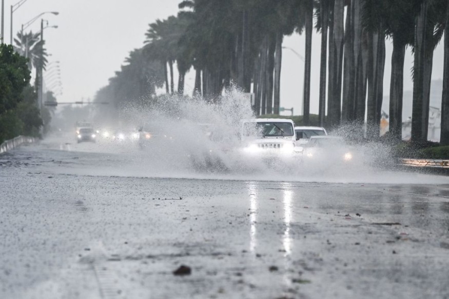
Based on its latest US weather alert, the NOAA's National Weather Service (NWS) stated heavy rain will continue to bring flash flooding and urban flooding in multiple areas across South Florida and the Keys in the coming days.
This is due to the system's current navigation of crossing the Sunshine State from the Gulf of Mexico into the Atlantic Ocean in a northeastward pattern.
According to the NWS Weather Prediction Center (WPC), the inclement weather is associated with the NHC's abbreviation of the system called "Potential Tropical Cyclone One" or "Potential Tropical Cyclone 1."
Although it failed to develop into a storm, the US agencies are still expecting it to strengthen as it moves away into the north Atlantic waters.
As of Saturday morning, June 4, the following areas in Florida recorded significant rainfall over the past 72 hours, as reported by AccuWeather:
- Miami
- Biscayne Park
- Palmetto Bay
- Key Largo
- Goulds
The WPC weather advisory remains applicable on Sunday, June 5 and Monday, June 6.
2022 Atlantic Hurricane Season
The intensity of the weather system caused a regional impact not only for the Southeast US but also to the Caribbean region.
In Cuba, at least two people have been reported killed as continuous heavy downpour led to massive flooding across the country, forcing the evacuation of approximately 2,000 people and resulting in power outages affecting 50,000 customers, according to the BBC.
This came after Hurricane Agatha killed nine people in Mexico, making it the strongest hurricane in the Central American country for the month of May.
According to an NOAA assessment on May 24, there is a 65% chance the region will see an above-average hurricane season, a 25% rate of near-normal season, and a small 10% chance of a below-normal season.
The US agency predicted that this could be the case due to the ongoing La Niña, a weather pattern that alters ocean surface temperatures in the Pacific Ocean which; affecting the global weather, including the frequency and intensity of storms.
© 2026 NatureWorldNews.com All rights reserved. Do not reproduce without permission.


