A cold front and low pressure system have delivered a blow to New South Wales and its surrounding regions in Australia, as of Monday night, May 30.
A downpour of heavy snow occurred in Sydney's western region due to a reported icy polar blast that has already covered most of the country at a time the winter season is beginning.
Prior to the winter storm system, Australian weather authorities have issued warnings for a cold snap and a pressure area with icy temperatures and damaging winds affecting portions of eastern New South Wales, southern Queensland, South Australia, Victoria, and Tasmania.
The officials also issued initial weather alerts for residents in the affected regions and advised to take precaution since potential severe thunderstorms with hail, torrential rain, and snow may occur anytime, especially in high-altitude areas.
This comes several months after the first quarter of 2022 brought heavy rain and widespread flooding in Queensland and New South Wales, causing multiple casualties, large-scale property damage, and travel disruption.
Wet Winter Weather
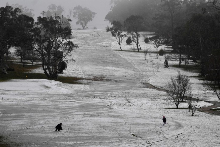
A winter system with cold temperatures navigated through South Australia then into Victoria before heading to New South Wales and Queensland on Monday, according to Nine News, Australia's national news service.
The system has brought a wet winter weather across New South Wales, where an ongoing severe weather warning remain in effect due to damaging winds with maximum winds gusts of up to 90 kilometers per hour.
The warning came as the strong winds impacted Sydney, accompanied by consistent rainfall in the following areas: Central West Slopes and Plains, South West Slopes, and Southern Tablelands.
Local authorities warned motorists to remain vigilant, slow down, and use their headlights due to the risk posed by snowfall.
Adelaide Suburb Tornado
A so-called mini tornado struck the Adelaide suburb of Salisbury on the early morning of Monday, downing power lines and tress, as well as damaging houses, according to the South Australian State Emergency Service (SASES), as cited by The Canberra Times.
Over 200 people reportedly called for help to SASES, claiming some roads became impassable due to the blockage of a large amount of debris.
The twister in Salisbury occurred as the said system passed through north of the city, bumping over 70 milimeters of rain in several areas.
Residents also resorted to Facebook and other social media platforms to post photos of the fallen debris along with damaged buildings and flooded roads, as reported by The Canberra Times.
Based on the local media reporting, a similar severe weather warning remains in place across the South Australia as well.
Australia Weather Forecast
Australia's Bureau of Meteorology (BoM) issued its latest weather forecast on the early afternoon of Monday, indicating that much of southern and eastern Australia will be impacted by the winter storm system and severe weather.
Aside from South Australia and New South Wales, the BoM also issued severe weather warnings for southern Queensland and northern Victoria.
These inclement weather and winter weather conditions have been forecasted to continue on Tuesday, May 31.
Meanwhile, damaging winds are expected regionally until Wednesday, June 1.
© 2026 NatureWorldNews.com All rights reserved. Do not reproduce without permission.


