Severe thunderstorms, including a tornado danger, and flooding rain will pound areas of the Southeast in waves through Saturday.
An EF1 tornado destroyed at least one vehicle and many structures in Barbour County, Alabama, southeast of Montgomery, on Wednesday morning.
Damage was also reported in Belleville, Alabama, while another tornado drove National Weather Service forecasters racing for safety in Mobile, Alabama, early Wednesday morning.
Both tornadoes were classified as EF1.
Thunderstorms will come on Friday night
According to The Weather Channel, warm and humid air coming in from the Gulf of Mexico near a waffling frontal boundary, along with jet stream impulses riding overhead, could cause scattered strong to severe thunderstorms and heavy rain from the northern Gulf Coast to the eastern Carolinas on Friday.
Severe thunderstorms, on the other hand, may become more common beginning Friday night and linger until at least Saturday morning.
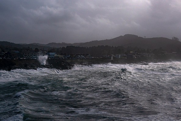
Because of a strong jet stream, low pressure in the Southeast will strengthen, eventually becoming a bomb cyclone in the Northeast United States later Saturday.
This will cause a powerful cold front to slash through the warm and humid Southeast, triggering severe thunderstorms from the northern Gulf Coast to the Southeast coast on Friday night.
These strong thunderstorms may produce damaging wind gusts and tornadoes, particularly in Florida Big Bend, and South Georgia.
The severe weather that began Friday night will most certainly continue Saturday morning near the Southeast coast, from southeast Virginia through the eastern Carolinas, southeast Georgia, and northern Florida.
This extreme weather could produce damaging winds and tornadoes.
The threat of severe weather will most likely stop in the morning hours for communities along the Southeast coast, but it may extend into the afternoon hours for sites further south into the Florida Peninsula.
Bomb Cyclone will come throughout the weekends
A "bomb cyclone" is expected to rip through the central and eastern United States this weekend.
The storm will bring a variety of hazardous weather to the end of winter, including heavy snow and ice, high winds, rain, and severe thunderstorms.
Tornadoes may form in the Southeast.
A bomb cyclone is a type of winter storm that is frequent along the Eastern Seaboard.
According to Scientific American, a typical huge storm becomes a "bomb cyclone" when it undergoes a process called bombogenesis and has a fast drop in air pressure over 24 hours.
Beginning Friday night and lasting through Saturday, a strengthening low-pressure system is expected to dump heavy snow throughout areas of the Ohio Valley and the interior eastern United States.
Driving may be difficult at times due to heavy snow, gusting gusts, and significantly limited visibility, particularly in western New York and Pennsylvania.
While it may appear counterintuitive, winter storms that dump more snow are a predictable result of the climate issue. As per Independent.
As the globe warms, more water evaporates and moisture accumulates in the atmosphere. This implies more severe downpours in the summer and heavy snow in the winter.
Forecasters were growing more optimistic that the winter storm will sweep up through the heartland of the United States and reach the East Coast late Friday into Saturday.
It would add to dangerous weather conditions in the country's central and eastern regions in the following days.
Winter storm warnings and advisories were issued for the Central Plains and the Middle Mississippi Valley, with up to 8 inches of snow likely.
Over mountain summits in the Southern Rockies, snow accumulations of more than a foot are possible.
© 2026 NatureWorldNews.com All rights reserved. Do not reproduce without permission.


