On January 15, a volcano in Tonga erupted, giving satellites their first view of a plume of volcanic ash flying into the mesosphere, Earth's third layer.
According to NASA, the volcanic explosion in Tonga was the greatest since satellites began monitoring our globe. Two weather satellites passed overhead as the Pacific volcano ejected ash and gases into the sky with the power of nearly ten megatons of TNT.
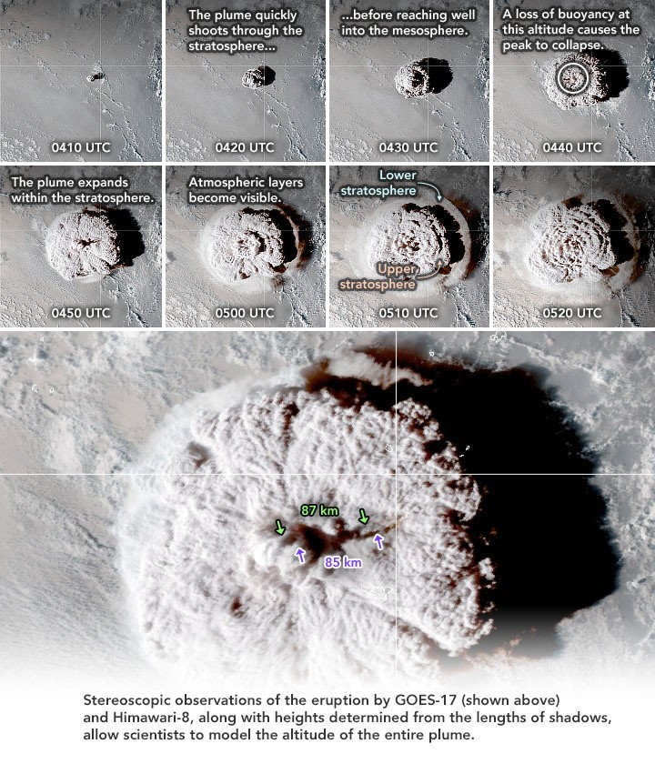
The GOES-17 and Himawari-8 spacecraft, operated by the National Oceanic and Atmospheric Administration and the Japanese Aerospace Exploration Agency, recorded the eruption in infrared every 10 minutes for roughly 13 hours.
Initial Eruption
According to NASA scientists analyzing satellite images, the initial eruption of ash flew 36 miles (58 kilometers) upward, shattering the mesosphere. In this zone, meteorites fall to Earth, burn up, and form shooting stars flashing across the night sky.
The volcanic plume took around 30 minutes to cover that distance. Then a second plume ascended to more than 31 miles (50 kilometers). Both are visible in the satellite images below, highlighted in yellow. Because of the dry conditions in the mesosphere, the upper half of the plumes converted to gas and disappeared very instantly.
Kristopher Bedka, a NASA atmospheric scientist who specializes in intense storms, said in a statement, "We are lucky that our newest generation of geostationary satellites captured it so effectively, and we can utilize this data in novel ways to chronicle its evolution."
Pinatubo Eruption
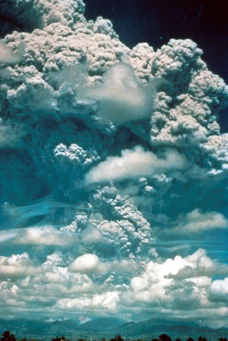
According to NASA, Mount Pinatubo's 1991 eruption was the largest volcanic plume ever caught by satellites. That plume soared 22 miles (35 kilometers) over the Philippines, high into the stratosphere, but missed the mesosphere.
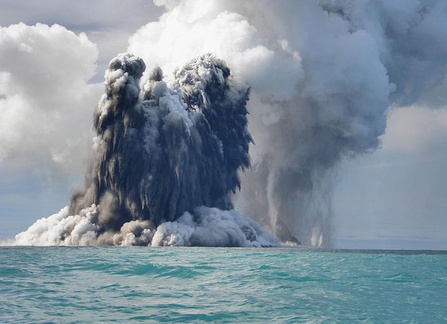
Tonga's volcano used to be fully submerged. When it erupted beneath the ocean and quickly surfaced, producing a landmass that united two previous islands, Hunga Tonga and Hunga Ha'apai, it drew the attention of scientists.
A sequence of severe eruptions in January wiped off the infant island. It ripped significant portions of Hunga Tonga and Hunga Ha'apai away, capping over a decade of low-level volcanic activity.
Although the region was deserted, the eruption and tsunami produced devastated homes, boats, and fisheries in surrounding populated islands and severing Tonga's underwater internet cable. The eruption claimed the lives of three persons. According to the World Bank, the catastrophe cost $90.4 million in damages or 20% of Tonga's GDP.
Satellite Mapping
Bedka and his NASA colleague Konstantin Khlopenkov utilized data from the two satellites to map the ash plume from the first eruption, similar to how our brains interpret images from our two eyes.
They used an algorithm to create a 3D profile of the plume by comparing the photos from the satellites and the varied angles at which they were shot. They created the technology to examine strong thunderstorms in the stratosphere.
Also Read : Tonga Volcanic Explosion Was Strong Enough to Send Gravitational Waves to the Atmosphere
For similar news, don't forget to follow Nature World News!
© 2026 NatureWorldNews.com All rights reserved. Do not reproduce without permission.


