AccuWeather experts warn that winter is in full swing over the eastern United States, with numerous chances for snow in the coming days, as well as the coldest air of the season so far.

Incoming Storm
In the aftermath of a huge snowfall that swept across the Northeast and into Canada, a cold and snowy trend is forming in the Northeast. As of Tuesday afternoon, most of central and eastern Tennessee, eastern Kentucky, and sections of Virginia were still covered with snow. Additional snow might fall before the previous snow has a chance to melt away.
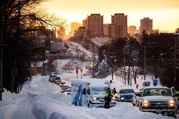
The next snowstorm won't be as severe as the one that hit the area last weekend, but it will be a nuisance for those who have to pick up after their cars or shovel sidewalks.
The heavy precipitation will fall along a cold front sweeping over the eastern United States, unlike larger storms like nor'easters, in which snow falls around a core region of low pressure.
Renee Duff, a meteorologist, stated, "A wave of moisture is anticipated to ride along the front edge of the cold push, causing rain to turn to snow along this swath."
From eastern Kentucky to mid-Atlantic areas, including near Washington, D.C., Philadelphia, and New York City, the morning commute might be choppy on Thursday.
Snowfall
So far in January, Washington, D.C., had received 12.1 inches of snow, the most since January 2016, when the city received 18.8 inches of snow in January. It's improbable that the city's monthly snowfall will reach this amount, but it will make it the snowiest month in a half-decade.
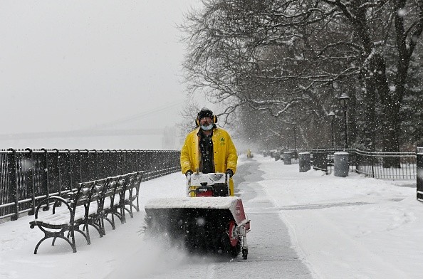
Although there isn't much snow anticipated farther south, motorists might still have problems getting about on Wednesday night and Thursday due to the weather.
"All rain falling at the front end of the storm is likely to make roads wet at first, but as colder air comes in and temperatures drop, a transition to snow can make roads hazardous," Duff added.
This quick freeze-up might result in slick patches on roadways and sidewalks, even in areas where no snow has fallen. Interstates 40, 65, and 75 are all part of this.
Cold Front
The cold front isn't expected to deliver snow as far south as it did during the weekend's snowfall, but it might bring some raging thunderstorms to parts of the Gulf Coast.
On Wednesday afternoon and into Wednesday night, the danger of locally destructive storms will be concentrated in southeastern Texas, Louisiana, and central Mississippi. Although a significant severe weather outbreak is unlikely, a couple of tornadoes are possible.
The same cold front that brought the snow will bring a fresh infusion of Arctic air, bringing the temperature down to its lowest point this winter for much of the country.
New Orleans, for example, near the Gulf Coast, might reach a threshold when temperatures drop below freezing on Thursday morning. Compared to the inner Northeast and Upper Midwest, where temperatures are anticipated to drop below zero degrees Fahrenheit, this will feel mild.
Colder Weather
This cold air will build up the next opportunity for wintry precipitation towards the end of the week and into the early part of the weekend.
If the storm builds rapidly, meteorologists warn that it may be worse than the midweek snow danger, with travel-snarling snow from the southern Appalachians to southern New England.
For more news about the environment , don't forget to follow Nature World News!
© 2026 NatureWorldNews.com All rights reserved. Do not reproduce without permission.


